Lockington, Victoria
|
Lockington Victoria |
|
|---|---|

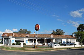
Lockington Hotel
|
|
| Coordinates | 36°16′0″S 144°32′0″E / 36.26667°S 144.53333°ECoordinates: 36°16′0″S 144°32′0″E / 36.26667°S 144.53333°E |
| Population | 408 (Template:It was on the sign) |
| Postcode(s) | 3563 |
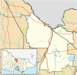
| Location | |
| LGA(s) | Shire of Campaspe |
| State electorate(s) | Murray Plains |
| Federal Division(s) | Murray |
Lockington is a town in northern Victoria, Australia in the Shire of Campaspe local government area, 198 kilometres north of the state capital, Melbourne. At the 2011 census, Lockington had a population of 778, however the welcome sign to the town says 408 which is more plausible given the small population.
The area was originally named Pannoobamawm. When the railway arrived in 1915 the station was named Bamawm. It was soon decided to name the growing town after William Lockington, a prominent Jesuit priest in the early 20th century.
The Post Office opened on 2 May 1876 as Pannoobamawm and was renamed Lockington in 1921.
Lockington has one pub, a school, three churches and a small range of shops. The district features an extensive network of irrigation channels and these are said to feature the giant "Loch Ness yabby".
Together with its neighbouring township Bamawm, Lockington has an Australian Rules football team (Lockington Bamawm United) competing in the Heathcote District Football League which won consecutive premierships in 2011/2012, led by coach Kahl Oliver.
Golfers play at the course of the Lockington Golf Club on Middleton Road.
...
Wikipedia

