Lihesten
| Lihesten | |
|---|---|
| Lifjellet | |

Lihesten in the background
|
|
| Highest point | |
| Elevation | 777 m (2,549 ft) |
| Prominence | 679 m (2,228 ft) |
| Isolation | 25.91 kilometres (16.10 mi) |
| Coordinates | 61°10′29″N 05°12′52″E / 61.17472°N 5.21444°ECoordinates: 61°10′29″N 05°12′52″E / 61.17472°N 5.21444°E |
| Geography | |
|
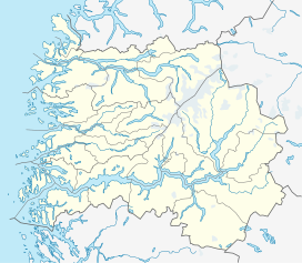
Location in Sogn og Fjordane
|
|
| Location | Sogn og Fjordane, Norway |
Lihesten or Lifjellet is a 776-meter (2,546 ft) tall mountain in Hyllestad Municipality in Sogn og Fjordane county, Norway. The mountain lies on a small peninsula between the Hyllestadfjorden and the Sognefjorden and it is the highest point in the municipality. The village of Hyllestad lies about 5 kilometres (3.1 mi) east of the mountain. It was the site of the Havørn Accident on 16 June 1936.
...
Wikipedia

