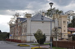
Libice nad Doubravou
| Libice nad Doubravou | |||
|---|---|---|---|
| Městys | |||
 |
|||
|
|||
| Coordinates: 49°44′43″N 15°42′17″E / 49.74528°N 15.70472°ECoordinates: 49°44′43″N 15°42′17″E / 49.74528°N 15.70472°E | |||
| Country |
|
||
| Region | Vysočina | ||
| District | Havlíčkův Brod | ||
| Area | |||
| • Total | 21.94 km2 (8.47 sq mi) | ||
| Elevation | 421 m (1,381 ft) | ||
| Population (1.1.2014) | |||
| • Total | 857 | ||
| • Density | 39/km2 (100/sq mi) | ||
| Postal code | 582 77 to 583 01 | ||
| Website | http://www.libicend.cz/ | ||
Libice nad Doubravou is a small town (městys) in Havlíčkův Brod District in the Vysočina Region of the Czech Republic.
The town covers an area of 21.94 square kilometres (8.47 sq mi), and has a population of 851 (as at 28 August 2006).
Libice nad Doubravou lies approximately 18 kilometres (11 mi) north-east of Havlíčkův Brod, 40 km (25 mi) north of Jihlava, and 100 km (62 mi) east of Prague.
...
Wikipedia


