Lewis County, Missouri
| Lewis County, Missouri | |
|---|---|

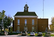
Lewis County Courthouse in Monticello
|
|
 Location in the U.S. state of Missouri |
|
 Missouri's location in the U.S. |
|
| Founded | January 2, 1833 |
| Named for | Meriwether Lewis |
| Seat | Monticello |
| Largest city | Canton |
| Area | |
| • Total | 511 sq mi (1,323 km2) |
| • Land | 505 sq mi (1,308 km2) |
| • Water | 5.8 sq mi (15 km2), 1.1% |
| Population (est.) | |
| • (2015) | 10,207 |
| • Density | 20/sq mi (8/km²) |
| Congressional district | 6th |
| Time zone | Central: UTC-6/-5 |
| Website | lewiscountymo |
| Lewis County, Missouri | ||||
|---|---|---|---|---|
| Elected countywide officials | ||||
| Assessor | Craig Myers | Democratic | ||
| Circuit Clerk | Jan E. Geisendorfer | Democratic | ||
| County Clerk | Sharon Schlager | Democratic | ||
| Collector | Robert E. (Bob) Veatch | Democratic | ||
|
Commissioner (Presiding) |
Wayne Murphy, Jr. | Republican | ||
|
Commissioner (District 1) |
John Campen | Democratic | ||
|
Commissioner (District 2) |
Jesse Roberts | Democratic | ||
| Coroner | Larry Arnold | Democratic | ||
| Prosecuting Attorney | Jules V. (Jake) DeCoster | Democratic | ||
| Public Administrator | Brett B. Bozarth | Democratic | ||
| Recorder | Brenda Gunlock | Democratic | ||
| Sheriff | David T. Parrish | Democratic | ||
| Surveyor | Jason D. Janes | Democratic | ||
| Treasurer | Kim Porter | Democratic | ||
| Lewis County, Missouri | ||
|---|---|---|
| 2008 Republican primary in Missouri | ||
| John McCain | 279 (34.23%) | |
| Mike Huckabee | 286 (35.09%) | |
| Mitt Romney | 197 (24.17%) | |
| Ron Paul | 32 (3.93%) | |
| Lewis County, Missouri | ||
|---|---|---|
| 2008 Democratic primary in Missouri | ||
| Hillary Clinton | 619 (53.50%) | |
| Barack Obama | 476 (41.14%) | |
| John Edwards (withdrawn) | 44 (3.80%) | |
| Uncommitted | 11 (0.95%) | |
Lewis County is a county located in the northeastern portion of the U.S. state of Missouri. As of the 2010 census, the population was 10,211. Its county seat is Monticello. The county was organized January 2, 1833 and named for Meriwether Lewis, the explorer and Governor of the Louisiana Territory.
Lewis County is part of the Quincy, IL–MO Micropolitan Statistical Area.
According to the U.S. Census Bureau, the county has a total area of 511 square miles (1,320 km2), of which 505 square miles (1,310 km2) is land and 5.8 square miles (15 km2) (1.1%) is water.
As of the census of 2010, there were 10,211 people, 3,956 households, and 2,709 families residing in the county. The population density was 21 people per square mile. The racial makeup of the county was 95.92% White, 2.53% Black or African American, 0.16% Native American, 0.20% Asian, 0.02% Pacific Islander, 0.44% from other races, and 0.73% from two or more races. Approximately 0.73% of the population were Hispanic or Latino of any race. 34.9% were of German, 18.3% American, 11.2% English and 10.8% Irish ancestry.
...
Wikipedia
