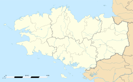
Les Portes du Coglais
| Les Portes du Coglais | |
|---|---|
| Commune | |

The town hall of Les Portes du Coglais
|
|
| Coordinates: 48°26′38″N 1°18′29″W / 48.444°N 1.308°WCoordinates: 48°26′38″N 1°18′29″W / 48.444°N 1.308°W | |
| Country | France |
| Region | Brittany |
| Department | Ille-et-Vilaine |
| Arrondissement | Fougères-Vitré |
| Canton | Antrain |
| Intercommunality | Couesnon Marches de Bretagne |
| Area1 | 40.71 km2 (15.72 sq mi) |
| Population (2013)2 | 2,339 |
| • Density | 57/km2 (150/sq mi) |
| Time zone | CET (UTC+1) |
| • Summer (DST) | CEST (UTC+2) |
| INSEE/Postal code | 35191 /35460 |
|
1 French Land Register data, which excludes lakes, ponds, glaciers > 1 km² (0.386 sq mi or 247 acres) and river estuaries. 2Population without double counting: residents of multiple communes (e.g., students and military personnel) only counted once. |
|
1 French Land Register data, which excludes lakes, ponds, glaciers > 1 km² (0.386 sq mi or 247 acres) and river estuaries.
Les Portes du Coglais is a commune in the department of Ille-et-Vilaine, western France. The municipality was established on 1 January 2017 by merger of the former communes of Montours (the seat), Coglès and La Selle-en-Coglès.
...
Wikipedia


