Leipsoi
|
Leipsoi Λειψοί |
|
|---|---|

Leipsoi, viewed from the harbour
|
|
| Coordinates: 37°18′N 26°45′E / 37.300°N 26.750°ECoordinates: 37°18′N 26°45′E / 37.300°N 26.750°E | |
| Country | Greece |
| Administrative region | South Aegean |
| Regional unit | Kalymnos |
| Area | |
| • Municipality | 17.35 km2 (6.70 sq mi) |
| Population (2011) | |
| • Municipality | 790 |
| • Municipality density | 46/km2 (120/sq mi) |
| Time zone | EET (UTC+2) |
| • Summer (DST) | EEST (UTC+3) |
| Postal code | 850 01 |
| Area code(s) | 22470 |
| Vehicle registration | ΚΧ, ΡΟ, ΡΚ |
| Website | http://www.Lipsi-Island.com/lipsi.html |
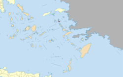
Leipsoi (Greek: Λειψοί, also: Lipsi) is an island south of Samos and to the north of Leros in Greece. It is well serviced with ferries passing between Patmos and Leros and on the main route for ferries from Piraeus. Leipsoi is a small group of islets at the northern part of the Dodecanese near to Patmos island and Leros. The larger Leipsi-Arkoi archipelago consists of some 37 islands and islets of which only three are larger than 1 square kilometre (247 acres): Leipsoi (15.95 square kilometres (6.16 sq mi)), Arkoi (6.7 square kilometres (2.59 sq mi), part of Patmos municipality) and Agreloussa (1.32 square kilometres (0.51 sq mi), part of Patmos municipality). Only Leipsoi, Arkoi and Marathos are inhabited. Leipsoi is a municipality, part of the Kalymnos regional unit, which is part of the South Aegean region. The municipality has an area of 17.350 square kilometres (6.699 sq mi).
The island contains springs at Fountani, alias Pikri Nero, in the area near Kimissi along with other minor springs also flowing in this region. The Cave of Ontas dominates the settlement. A 960-metre-long (3,150 ft) paved path carved into the hill connects the upper quarters of Kimissi with the lower ones.
Local products, namely thyme honey (produced the traditional way), wine, cheese, dairy products (touloumotyri cheese, the local version of mizithra) and grapes. Also loom-woven fabrics, carpets and "fookadia" (cloth pouches used to strain cheese).
Most of the secluded and protected bays like Moschato Bay in the north on this island have been spoilt by fish farming. The water in these bays is often very cloudy with fish farm wastage. The less protected beaches are not polluted and easily reached by the road network. Roads have recently been reconstructed using European Union funding.
There are several churches and monasteries scattered around the island dedicated to a multitude of saints. These include the church of Aghios Nektarios, built in or about 1980 by father Nikiforos, the parochial priest of Lipsi at the time and a favorite baptistry for the inhabitants of the island.
...
Wikipedia


