Lee County (Mississippi)
| Lee County, Mississippi | |
|---|---|
| County | |
| County of Lee | |

South façade of Lee Courthouse, 2013
|
|
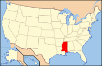
 Location in the U.S. state of Mississippi |
|
 Mississippi's location in the U.S. |
|
| Founded | October 26, 1866 |
| Named for | General Robert E. Lee |
| Seat | Tupelo |
| Largest city | Tupelo |
| Area | |
| • Total | 453 sq mi (1,173 km2) |
| • Land | 450 sq mi (1,165 km2) |
| • Water | 3.2 sq mi (8 km2), 0.7% |
| Population | |
| • (2010) | 82,910 |
| • Density | 184/sq mi (71/km²) |
| ZIP code(s) | 38801, 38804, 38824, 38826, 38828, 38843, 38849, 38857, 38858, 38860, 38862, 38866, 38868, 38879 |
| Area code(s) | 662 |
| Congressional district | 1st |
| Time zone | Central: UTC-6/-5 |
| Website | leecoms |
Lee is a county in Mississippi. As of the 2010 census, the population was 82,910. The county seat is Tupelo. Lee County is included in the Tupelo Micropolitan Statistical Area.
Lee County was established on October 26, 1866, and named for Robert E. Lee,General in Chief of the Armies of the Confederate States. It was carved from Itawamba and ; therefore, the record and list of pioneers mentioned in those counties embrace a great number who were residents of what is now Lee.
According to the U.S. Census Bureau, the county has a total area of 453 square miles (1,170 km2), of which 450 square miles (1,200 km2) is land and 3.2 square miles (8.3 km2) (0.7%) is water.
As of the census of 2000, there were 75,755 people, 29,200 households, and 20,819 families residing in the county. The population density was 168 people per square mile (65/km²). There were 31,887 housing units at an average density of 71 per square mile (27/km²). The racial makeup of the county was 73.66% White, 24.51% Black or African American, 0.13% Native American, 0.52% Asian, 0.01% Pacific Islander, 0.43% from other races, and 0.74% from two or more races. 1.16% of the population were Hispanic or Latino of any race.
...
Wikipedia
