Lee County, Virginia
| Lee County, Virginia | |
|---|---|
 Location in the U.S. state of Virginia |
|
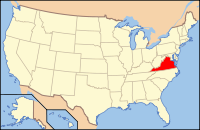
 Virginia's location in the U.S. |
|
| Founded | October 25, 1792 |
| Named for | Light Horse Harry Lee |
| Seat | Jonesville |
| Largest town | Pennington Gap |
| Area | |
| • Total | 437 sq mi (1,132 km2) |
| • Land | 436 sq mi (1,129 km2) |
| • Water | 1.9 sq mi (5 km2), 0.4% |
| Population (est.) | |
| • (2015) | 24,742 |
| • Density | 57/sq mi (22/km²) |
| Congressional district | 9th |
| Time zone | Eastern: UTC-5/-4 |
| Website | www |
Lee County is the westernmost county in the U.S. Commonwealth of Virginia. As of the 2015 estimate, the population was 24,742. Its county seat is Jonesville.
The first Europeans to enter what is present-day Lee County were a party of Spanish explorers, Juan de Villalobos and Francisco de Silvera, sent by Hernando de Soto in 1540, in search of gold.
The county was formed in 1793 from Russell County. It was named for Light Horse Harry Lee, the Governor of Virginia from 1791 to 1794, who was known as "Light Horse Harry" for his exploits as a leader of light troops in the American Revolutionary War. He was the father of the Confederate General Robert E. Lee.
Lee County was the final front on the Kentucky Trace, which has become known as the Wilderness Road and The Trail of the Lonesome Pine. During the 1780s and 1790s, fortified buildings ("stations") were erected as protection from Indian raids while they followed Daniel Boone's footsteps to the new region of Kentucky. Stations or forts during that time were: Far Eastern Lee County Yoakum Station at present-day Dryden, westward to Powell River and Station Creek at present-day Rocky Station, then to Mump's Fort at present day Jonesville, Prist Station, Chadwell Station at present-day Chadwell Gap, Martin's Station at present-day Rose Hill, Owen Station at present-day Ewing, and finally Gibson Station, which still holds its name.
...
Wikipedia
