Dryden, Virginia
| Dryden, Virginia | |
|---|---|
| CDP | |

Dryden
|
|
| Nickname(s): Yokum Station | |
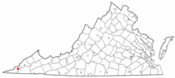
 Location of Dryden, Virginia |
|
| Coordinates: 36°46′33″N 82°56′39″W / 36.77583°N 82.94417°WCoordinates: 36°46′33″N 82°56′39″W / 36.77583°N 82.94417°W | |
| Country | United States |
| State | Virginia |
| County | Lee |
| Area | |
| • Total | 7.1 sq mi (18.5 km2) |
| • Land | 7.1 sq mi (18.5 km2) |
| • Water | 0.0 sq mi (0.0 km2) |
| Elevation | 1,440 ft (439 m) |
| Population (2010) | |
| • Total | 1,208 |
| • Density | 170/sq mi (65/km2) |
| Time zone | Eastern (EST) (UTC-5) |
| • Summer (DST) | EDT (UTC-4) |
| ZIP code | 24243 |
| Area code(s) | 276 |
| FIPS code | 51-23584 |
| GNIS feature ID | 1483150 |
Dryden is a census-designated place (CDP) in Lee County, Virginia, United States. The population was 1,208 at the 2010 census.
The Dryden post office was established in 1879. The community was named for Captain Dryden, a railroad official.
Dryden is located at 36°46′33″N 82°56′39″W / 36.77583°N 82.94417°W (36.775836, -82.944157). The community is concentrated in an area just off U.S. Route 58 northeast of Pennington Gap and southwest of Big Stone Gap. Dryden's southern border is the Powell River, and parts of the Jefferson National Forest lie to the north.
As of the census of 2000, there were 1,253 people, 453 households, and 329 families residing in the CDP. The population density was 175.9 people per square mile (67.9/km²). There were 507 housing units at an average density of 71.2/sq mi (27.5/km²). The racial makeup of the CDP was 98.64% White, 0.72% African American, 0.32% Native American, 0.24% Asian, and 0.08% from two or more races. Hispanic or Latino of any race were 0.16% of the population.
...
Wikipedia
