Lebanon, KY
| Lebanon, Kentucky | |
|---|---|
| City | |

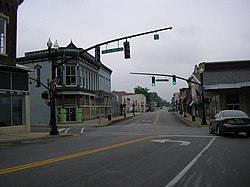
Downtown Lebanon
|
|
 Location of Lebanon in Marion County, Kentucky. |
|
| Coordinates: 37°34′14″N 85°15′23″W / 37.57056°N 85.25639°WCoordinates: 37°34′14″N 85°15′23″W / 37.57056°N 85.25639°W | |
| Country | United States |
| State | Kentucky |
| County | Marion |
| Named for | the biblical land famed for its cedars |
| Area | |
| • Total | 4.4 sq mi (7.1 km2) |
| • Land | 4.4 sq mi (7.1 km2) |
| • Water | 0.0 sq mi (0.0 km2) |
| Elevation | 791 ft (241 m) |
| Population (2010) | |
| • Total | 5,539 |
| • Estimate (2016) | 5,638 |
| • Density | 1,438.9/sq mi (891.7/km2) |
| Time zone | Eastern (EST) (UTC-5) |
| • Summer (DST) | EDT (UTC-4) |
| ZIP code | 40033 |
| Area code(s) | 270 & 364 |
| FIPS code | 21-44344 |
| GNIS feature ID | 0496130 |
| Website |
lebanon www |
Lebanon is a home rule-class city in Marion County, Kentucky, in the United States. The population was 6,331 at the 2010 census. It is the seat of its county. Lebanon is located in central Kentucky, southeast of Louisville. A national cemetery is located nearby.
Lebanon is renowned for its Ham Days Festival and Tractor Show which is held during the last weekend of September. In the 1960s and early 1970s, it was known as an entertainment hotspot, as nationally known acts appeared at Club 68 and the Golden Horseshoe nightclubs.
Lebanon is located at 37°34′14″N 85°15′23″W / 37.57056°N 85.25639°W (37.570623, -85.256263). It is approximately 30 miles (48 km) from Danville and 20 miles (32 km) north of Campbellsville. It is located at the junction of US 68 and Ky. 55, Ky. 52, and Ky. 49. Ky. 84 intersects Ky. 49 and 52 just west of town.
According to the United States Census Bureau, the city has a total area of 4.4 square miles (11.4 km2), all land.
As of the census of 2000, there were 5,718 people, 2,332 households, and 1,476 families residing in the city. The population density was 1,296.6 per square mile (500.6/km2). There were 2,555 housing units at an average density of 579.3 per square mile (223.7/km2). The racial makeup of the city was 77.88% White, 19.92% African American, 0.12% Native American, 0.73% Asian, 0.47% from other races, and 0.87% from two or more races. Hispanic or Latino of any race were 1.03% of the population.
...
Wikipedia
