Le Mesnil-Saint-Denis
| Le Mesnil-Saint-Denis | ||
|---|---|---|
| Commune | ||

Town hall
|
||
|
||
| Coordinates: 48°44′39″N 1°57′50″E / 48.7442°N 1.9639°ECoordinates: 48°44′39″N 1°57′50″E / 48.7442°N 1.9639°E | ||
| Country | France | |
| Region | Île-de-France | |
| Department | Yvelines | |
| Arrondissement | Rambouillet | |
| Canton | Maurepas | |
| Government | ||
| • Mayor (2001–2008) | Jean Creno | |
| Area1 | 8.95 km2 (3.46 sq mi) | |
| Population (2006)2 | 6,747 | |
| • Density | 750/km2 (2,000/sq mi) | |
| Time zone | CET (UTC+1) | |
| • Summer (DST) | CEST (UTC+2) | |
| INSEE/Postal code | 78397 /78320 | |
| Elevation | 120–177 m (394–581 ft) (avg. 168 m or 551 ft) |
|
|
1 French Land Register data, which excludes lakes, ponds, glaciers > 1 km² (0.386 sq mi or 247 acres) and river estuaries. 2Population without double counting: residents of multiple communes (e.g., students and military personnel) only counted once. |
||
1 French Land Register data, which excludes lakes, ponds, glaciers > 1 km² (0.386 sq mi or 247 acres) and river estuaries.
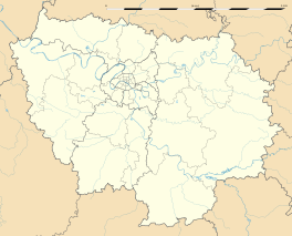
Le Mesnil-Saint-Denis is a commune in the Yvelines department in the Île-de-France region in north-central France.
The commune has two public preschools, Maternelle de Champmesnil and Maternelle du Bois du Fay, as well as two public elementary schools, Elémentaire de Champmesnil and Elémentaire du Bois du Fay. It also hosts two junior high schools, the public Collège Philippe de Champaigne and the private Collège privé Saint Thérèse. Collège Philippe de Champaigne also serves residents of La Verrière.
...
Wikipedia


