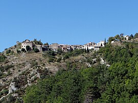
Le Mas
| Le Mas | ||
|---|---|---|

A general view of the village
|
||
|
||
| Coordinates: 43°50′38″N 6°51′33″E / 43.8439°N 6.8592°ECoordinates: 43°50′38″N 6°51′33″E / 43.8439°N 6.8592°E | ||
| Country | France | |
| Region | Provence-Alpes-Côte d'Azur | |
| Department | Alpes-Maritimes | |
| Arrondissement | Grasse | |
| Canton | Saint-Auban | |
| Intercommunality | Pays de Grasse | |
| Government | ||
| • Mayor (2008–2014) | Fabrice Lachenmaier | |
| Area1 | 32.15 km2 (12.41 sq mi) | |
| Population (2010)2 | 169 | |
| • Density | 5.3/km2 (14/sq mi) | |
| Time zone | CET (UTC+1) | |
| • Summer (DST) | CEST (UTC+2) | |
| INSEE/Postal code | 06081 /06910 | |
| Elevation | 440–1,689 m (1,444–5,541 ft) | |
|
1 French Land Register data, which excludes lakes, ponds, glaciers > 1 km² (0.386 sq mi or 247 acres) and river estuaries. 2Population without double counting: residents of multiple communes (e.g., students and military personnel) only counted once. |
||
1 French Land Register data, which excludes lakes, ponds, glaciers > 1 km² (0.386 sq mi or 247 acres) and river estuaries.
Le Mas (Occitan: Lo Mas) is a French commune in the Alpes-Maritimes department in the Provence-Alpes-Côte d'Azur region of South-eastern France.
The inhabitants of the commune are known as Massois, Massoises, or Massoinques.
Le Mas is located some 45 km north-west of Nice and 32 km east of Castellane in a direct line. Access to the commune is by road D10 which branches from the D5 road on the western border of the commune and passes through the length of the commune through the village before continuing to Aiglun in the east. The D110 branches from the D10 in the west of the commune and passes along the river valley to rejoin the D10 east of the village. The commune is alpine in nature with high mountains and alpine valleys throughout.
The Gironde river flows through the commune from west to east to join the Estéron which forms the eastern border of the commune as it flows south then east joining the Var at Saint-Martin-du-Var. Numerous tributaries feed the Gironde in the commune.
Isnard, from the House of Grasse, Commander of St. John of Jerusalem, Prior of Capua, Grand Seneschal of Provence, in recognition of his services received the lands of Mas and Aiglun from Queen Jeanne on 7 July 1348. He donated the land of Aiglun to his cousin Pons of Ferres on 18 May 1349. The fief of Mas passed down to Bertrand II de Grasse. The Grasse family lost the lordship of Mas at the time of the separation of Nice and it subsequently remained with the Counts of Provence.
In 1713 the Treaty of Utrecht provided that Ubaye and its dependencies, formerly under the Kingdom of Piedmont-Sardinia, were exchanged for the French areas in the Susa Valley so that the boundary followed the line of the watershed. But the overlapping of territories inherited from history remained: Entraunes and Saint-Martin-d'Entraunes were dependent on Barcelonnette but are in the Var valley while the Piedmontese side upstream of Guillaumes was already French. The Kingdoms of France and Piedmont both claimed them. In addition, in the Estéron Valley the right bank of the Var was Piedmontese which created a tongue of land jutting out into French Provence. In Haut-Var it was ultimately the line of the watershed which prevailed. To provide compensation to France and to reduce the irregularity of the border, the community of Mas was ceded to France in 1718.
...
Wikipedia


