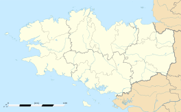
Laz, Finistère
|
Laz Laz |
||
|---|---|---|
| Commune | ||

The church of Saint-Germain and Saint-Louis, in Laz
|
||
|
||
| Coordinates: 48°08′18″N 3°50′02″W / 48.1383°N 3.8339°WCoordinates: 48°08′18″N 3°50′02″W / 48.1383°N 3.8339°W | ||
| Country | France | |
| Region | Brittany | |
| Department | Finistère | |
| Arrondissement | Châteaulin | |
| Canton | Briec | |
| Intercommunality | Haute Cornouaille | |
| Government | ||
| • Mayor (2014–2020) | Annick Barré | |
| Area1 | 34.44 km2 (13.30 sq mi) | |
| Population (2008)2 | 743 | |
| • Density | 22/km2 (56/sq mi) | |
| Time zone | CET (UTC+1) | |
| • Summer (DST) | CEST (UTC+2) | |
| INSEE/Postal code | 29122 /29520 | |
| Elevation | 31–295 m (102–968 ft) | |
|
1 French Land Register data, which excludes lakes, ponds, glaciers > 1 km² (0.386 sq mi or 247 acres) and river estuaries. 2Population without double counting: residents of multiple communes (e.g., students and military personnel) only counted once. |
||
1 French Land Register data, which excludes lakes, ponds, glaciers > 1 km² (0.386 sq mi or 247 acres) and river estuaries.
Laz is a commune in the Finistère department of Brittany in north-western France.
The commune is situated at the heart of a hilly and forest-covered region called the Montagnes Noires (black mountains) which extends for approximately 30 kilometres between the communes of Gourin to the east and Gouezec in the west.
The population of the commune is quite scattered, forming small settlements that could be considered as hamlets. Laz offers exceptional scenic outlooks over the valley of the Odet to the south and the canalized Aulne river and its serene locks to the north.
Agricultural development was held back by the French revolution and the subsequent royalist revolt, combined with poor soil conditions. The commune started to grow in the middle of the 19th century, when the use of fertiliser and other new techniques allowed the land to be brought into full agricultural use.
Inhabitants of Laz are called in French Laziens.
...
Wikipedia


