Laramie County
| Laramie County, Wyoming | |
|---|---|
| County | |
| Laramie County | |

The City and County Building at Cheyenne in 1981
|
|
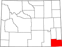
 Location in the U.S. state of Wyoming |
|
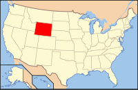
 Wyoming's location in the U.S. |
|
| Founded | January 9, 1867 |
| Named for | Jacques La Ramee |
| Seat | Cheyenne |
| Largest city | Cheyenne |
| Area | |
| • Total | 2,688 sq mi (6,962 km2) |
| • Land | 2,686 sq mi (6,957 km2) |
| • Water | 1.6 sq mi (4 km2), 0.06% |
| Population (est.) | |
| • (2015) | 97,121 |
| • Density | 36/sq mi (14/km²) |
| Congressional district | At-large |
| Time zone | Mountain: UTC-7/-6 |
| Website | webgate |
Laramie County is a county in the southeastern corner of the U.S. state of Wyoming. As of the 2010 census, the population was 91,738 making it the most populous county in Wyoming. The county seat is Cheyenne, the state capital. The county lies west of the Nebraska state line and north of the Colorado state line.
Laramie county comprises the Cheyenne, WY Metropolitan Statistical Area. It is the least populous county that is the most populous in a state.
The city of Laramie, Wyoming, is in neighboring Albany County, Wyoming.
Laramie County was originally created in 1867 as a county within the Dakota Territory. The county was named for Jacques La Ramee, a French-Canadian fur-trader. In late 1867, Laramie County lost territory when Sweetwater County was created.
In 1868, Laramie County also lost territory when Albany County and Carbon County were created. Laramie County became a county in the Wyoming Territory when the territorial government was formed in 1869. Crook County was created with land ceded by Laramie County in 1875. A few years later in 1888, Converse County was also formed from a portion of Laramie County. In 1911, Goshen and Platte Counties were formed from another part of Laramie County, and at that point the county achieved its current boundaries.
...
Wikipedia
