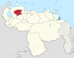
Lara (state)
| Lara | ||
|---|---|---|
| State of Venezuela | ||
|
||
| Anthem: Himno del Estado Lara | ||
 Location within Venezuela |
||
| Coordinates: 10°04′N 69°52′W / 10.07°N 69.86°WCoordinates: 10°04′N 69°52′W / 10.07°N 69.86°W | ||
| Country | Venezuela | |
| Created | 1901 | |
| Capital | Barquisimeto | |
| Government | ||
| • Governor | Henri Falcón (2008–present) | |
| Area | ||
| • Total | 19,800 km2 (7,600 sq mi) | |
| Area rank | 11th | |
| 2.15% of Venezuela | ||
| Population (2011 census) | ||
| • Total | 1,774,867 | |
| • Rank | 5th | |
| 6,75% of Venezuela | ||
| Time zone | UTC-04:30 | |
| ISO 3166 code | VE-K | |
| Emblematic tree | Semeruco (Malpighia glabra) | |
| Website | www |
|
Lara State (Spanish: Estado Lara, IPA: [esˈtaðo ˈlaɾa]) is one of the 23 states (estados) into which Venezuela is divided. The state capital is Barquisimeto.
Lara State covers a total surface area of 19,800 km2 (7,600 sq mi) and, in 2011, had a census population of 1,774,867.
The state is titled in honor of Jacinto Lara, hero of Independence of Venezuela.
Two types of climate prevail in Lara state: Tropical, Mountain, and also dry and very dry, followed by wet mountain. Mountain humid climates are low and humid paramero just 4.8% of estadal area. The dry atmosphere is typical, since evaporation exceeds precipitation, reaching until 650 mm of annual average, with rain falling at different times according to geographycal location..
The average annual temperature fluctuates between 19 °C (66,2 °F) and 29 °C (84,2 °F) , with an average of 24 °C (75,2 °F) in the capital, Barquisimeto.
The climate tends to vary between cold moor (in mountainous areas) and semi-arid tropical dry climate (specific in the area of the Lara´s Depression, where the city of Carora and surrounding populations are located).
The waters of the rivers in the state are drained by three aspects:. The Caribbean sea, the Atlantic ocean, through the Orinoco River and Maracaibo´s Lake .
Main rivers: Amarillo, Auro, Aragua, Curarigua, Morere, Tocuyo, Turbio, Urama, Yacambú.
Lagoons: Laguna Amarilla, Laguna Cocoy. Wine waterfall in the Dinira National Park
According to the 2011 Census, the racial composition of the population was:
The cultivation of sugarcane has become one of the leading and first sugar states. Also, products like coffee, potatoes, tomatoes, beans , corn, and banana . The Grape cultivation it´s associated with it the wine industry. Has an important livestock of cattle, pigs, goats, sheep, and poultry with good cheese and dairy industry. It also has important industrial areas and production capacity. It has great artisan wealth and potential tourism development, natural beauties, and folkloric and cultural events.
Among the most important industries in the state of Lara are the metalworking (Turbio´s steel industry, SIDETUR; food processing, clothing apparel, textile printing and processing (based sisal fiber) sector. The most manufacturing are in the small and medium industry because, except for its sugar mills, Almost all its industrial park consists of companies of less than two hundred workers
...
Wikipedia

