Langrickenbach
| Langrickenbach | ||
|---|---|---|
 |
||
|
||
| Coordinates: 47°34′N 9°13′E / 47.567°N 9.217°ECoordinates: 47°34′N 9°13′E / 47.567°N 9.217°E | ||
| Country | Switzerland | |
| Canton | Thurgau | |
| District | Kreuzlingen | |
| Area | ||
| • Total | 10.85 km2 (4.19 sq mi) | |
| Elevation | 522 m (1,713 ft) | |
| Population (Dec 2015) | ||
| • Total | 1,276 | |
| • Density | 120/km2 (300/sq mi) | |
| Postal code | 8585 | |
| SFOS number | 4681 | |
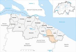
| Surrounded by | Altnau, Birwinken, Erlen, Güttingen, Lengwil, Münsterlingen, Sommeri | |
| Website |
www SFSO statistics |
|
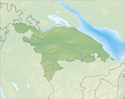
Langrickenbach is a municipality in the district of Kreuzlingen in the canton of Thurgau in Switzerland.
Langrickenbach is first mentioned in 889 as Rihchinbahc. Together with Greuter, it was acquired by the Lords of Helmsdorf in 1351. Between 1521 and 1798 it belonged to the cathedral of Konstanz. Any low court verdict in Langrickenbach was automatically appealed to the high court at Konstanz. Most of the settlement of Belzstadel belonged to Münsterlingen until 1798. A village church was first mentioned around 900. Since the Protestant Reformation in 1529 the Catholics attend the church in Altnau. The current municipality was formed in 1998 when Herrenhof, Langrickenbach, Schönenbaumgarten and Zuben merged into Langrickenbach.
Langrickenbach has an area, as of 2009[update], of 10.85 square kilometers (4.19 sq mi). Of this area, 8.25 km2 (3.19 sq mi) or 76.0% is used for agricultural purposes, while 1.8 km2 (0.69 sq mi) or 16.6% is forested. Of the rest of the land, 0.79 km2 (0.31 sq mi) or 7.3% is settled (buildings or roads), 0.03 km2 (7.4 acres) or 0.3% is either rivers or lakes.
Of the built up area, industrial buildings made up 4.1% of the total area while housing and buildings made up 0.1% and transportation infrastructure made up 0.2%. Parks, green belts and sports fields made up 2.9%. All of the forested land area is covered with heavy forests. Of the agricultural land, 64.1% is used for growing crops, while 12.0% is used for orchards or vine crops. All the water in the municipality is flowing water.
The municipality is located in the Kreuzlingen district at the intersection of the Sulgen-Altnau and Amriswil-Konstanz roads. It consists of the village of Langrickenbach (with the sections of Belzstadel and Unter-Greut) and the settlements of Dünnershaus, Herrenhof, Illighausen, Schönenbaumgarten and Zuben.
...
Wikipedia


