Güttingen
| Güttingen | ||
|---|---|---|
 |
||
|
||
| Coordinates: 47°36′N 9°18′E / 47.600°N 9.300°ECoordinates: 47°36′N 9°18′E / 47.600°N 9.300°E | ||
| Country | Switzerland | |
| Canton | Thurgau | |
| District | Kreuzlingen | |
| Area | ||
| • Total | 9.49 km2 (3.66 sq mi) | |
| Elevation | 396 m (1,299 ft) | |
| Population (Dec 2015) | ||
| • Total | 1,574 | |
| • Density | 170/km2 (430/sq mi) | |
| Postal code | 8594 | |
| SFOS number | 4656 | |
| Surrounded by | Altnau, Hagnau am Bodensee (DE-BW), Immenstaad am Bodensee (DE-BW), Kesswil, Langrickenbach, Sommeri, Stetten (DE-BW) | |
| Website |
www SFSO statistics |
|
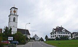
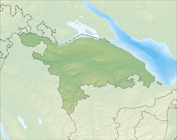
Güttingen is a municipality in the district of Kreuzlingen in the canton of Thurgau in Switzerland.
The earliest traces of human settlement in the area now occupied by the municipality is the Stone Age settlement at Rotfarb/Moosburg which dates from the 4th millennium BC. During the Early Middle Ages there was an Alamanni grave yard in the area. The modern village of Güttingen is first mentioned in 799 as Cutaningin though this comes from a 9th Century copy of the earlier record. In 1155 it was mentioned as Guthingen. The major landlords in Güttingen were the Bishop of Constance and the Abbey of St. Gall. Between 1159 and 1357 the Freiherr of Güttingen were mentioned as landlords and owner of Vogtei In 1359, it became part of the bailiwick of the Lords of Breitenlandenberg. The Bishop of Constance reacquired the Diocese's rights and property in the village in 1452. He held onto these rights until 1798. The bishop appointed a chief bailiff who ruled and held the low court for the village in the castle.
By 1275 there was a church in Güttingen. The right to appoint the church's priest was probably held by the Freiherr of Güttingen. During the Protestant Reformation, the majority in the village converted to the new faith. However, from 1554 to 1848, Kreuzlingen Abbey held the right to appoint the priest. The village church became a shared church, and has remained shared by Catholics and Protestants.
...
Wikipedia


