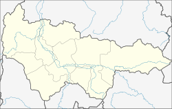
Langepas
| Langepas (English) Лангепас (Russian) |
|
|---|---|
| - Town - | |
 Location of Khanty-Mansi Autonomous Okrug in Russia |
|
|
|
|
|
|
|
|
|
|
| Administrative status (as of December 2009) | |
| Country | Russia |
| Federal subject | Khanty–Mansi Autonomous Okrug |
| Administratively subordinated to | town of okrug significance of Langepas |
| Administrative center of | town of okrug significance of Langepas |
| Municipal status (as of December 2009) | |
| Urban okrug | Langepas Urban Okrug |
| Administrative center of | Langepas Urban Okrug |
| Representative body | Duma |
| Statistics | |
| Population (2010 Census) | 41,670 inhabitants |
| Time zone | YEKT (UTC+05:00) |
| Founded | 1980 |
| Town status since | 1985 |
| Postal code(s) | 628671, 628672 |
| on | |
Langepas (Russian: Лангепас) is a town in Khanty-Mansi Autonomous Okrug, Russia, located on the Kayukovskaya River 15 kilometers (9.3 mi) north of the right bank of the Ob River, 545 kilometers (339 mi) east of Khanty-Mansiysk, and 875 kilometers (544 mi) northeast of Tyumen. Population: 41,670 (2010 Census);37,182 (2002 Census);25,618 (1989 Census).
Langepas means "squirrel channel" in the Khanty language. It was established in 1980 and granted town status in 1985.
Within the framework of administrative divisions, it is incorporated as the town of okrug significance of Langepas—an administrative unit with the status equal to that of the districts. As a municipal division, the town of okrug significance of Langepas is incorporated as Langepas Urban Okrug.
Economy of the town is based on oil and natural gas extraction.
...
Wikipedia


