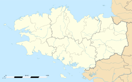
Lanester
|
Lanester Lannarstêr |
||
|---|---|---|

The ship graveyard on the Blavet river
|
||
|
||
| Coordinates: 47°45′53″N 3°20′32″W / 47.7647°N 3.3422°WCoordinates: 47°45′53″N 3°20′32″W / 47.7647°N 3.3422°W | ||
| Country | France | |
| Region | Brittany | |
| Department | Morbihan | |
| Arrondissement | Lorient | |
| Canton | Lanester | |
| Intercommunality | Pays de Lorient | |
| Government | ||
| • Mayor (2008—2014) | Thérèse Thiery | |
| Area1 | 18.37 km2 (7.09 sq mi) | |
| Population (1999)2 | 21,897 | |
| • Density | 1,200/km2 (3,100/sq mi) | |
| Time zone | CET (UTC+1) | |
| • Summer (DST) | CEST (UTC+2) | |
| INSEE/Postal code | 56098 / 56600 | |
| Elevation | 0–51 m (0–167 ft) | |
|
1 French Land Register data, which excludes lakes, ponds, glaciers > 1 km² (0.386 sq mi or 247 acres) and river estuaries. 2Population without double counting: residents of multiple communes (e.g., students and military personnel) only counted once. |
||
1 French Land Register data, which excludes lakes, ponds, glaciers > 1 km² (0.386 sq mi or 247 acres) and river estuaries.
Lanester (Breton: Lannarstêr) is a commune in the Morbihan department in Brittany, in north-western France.
It is the largest suburb of the city of Lorient, across the river Scorff to the east.
Inhabitants of Lanester are called Lanestériens.
The municipality launched a linguistic plan through Ya d'ar brezhoneg on July the 13th of 2006.
In 2008, there was 5,67% of the children attended the bilingual schools in primary education.
...
Wikipedia


