Lake Shetek State Park
| Lake Shetek State Park | |
| Minnesota State Park | |
|
Rental rowboats and a WPA-built causeway to Loon Island
|
|
| Named for: Lake Shetek | |
| Country | United States |
|---|---|
| State | Minnesota |
| County | Murray |
| Location | The Lakes |
| - elevation | 1,506 ft (459 m) |
| - coordinates | 44°6′14″N 95°41′25″W / 44.10389°N 95.69028°WCoordinates: 44°6′14″N 95°41′25″W / 44.10389°N 95.69028°W |
| Area | 1,109 acres (449 ha) |
| Founded | 1937 |
| Management | Minnesota Department of Natural Resources |
|
Lake Shetek State Park WPA/Rustic Style Group Camp
|
|

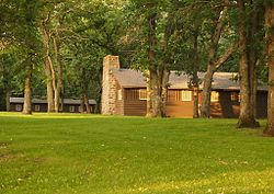
The Zuya Group Center
|
|
| Area | 2.5 acres (1.0 ha) |
|---|---|
| Built | 1940–1941 |
| Architect | Harold Peterson, N. Nielsen, Works Progress Administration |
| Architectural style | National Park Service rustic |
| MPS | Minnesota State Park CCC/WPA/Rustic Style MPS |
| NRHP Reference # | 92000777 |
| Added to NRHP | July 2, 1992 |
|
Lake Shetek State Park WPA/Rustic Style Historic District
|
|

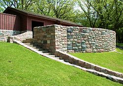
The Lake Shetek beachhouse
|
|
| Area | 34 acres (14 ha) |
|---|---|
| Built | 1938–1941 |
| Architectural style | National Park Service rustic |
| MPS | Minnesota State Park CCC/WPA/Rustic Style MPS |
| NRHP Reference # | 89001656 |
| Added to NRHP | July 2, 1992 |
Lake Shetek State Park is a state park of Minnesota, United States, on Lake Shetek, which is the largest lake in southwestern Minnesota and the headwaters of the Des Moines River. It is most popular for water recreation and camping. However the park also contains historical resources related to the Dakota War of 1862, including an original log cabin and a monument to 15 white settlers killed there and at nearby Slaughter Slough on August 20, 1862.
The park and lake were developed by the Works Progress Administration during the Great Depression. Two districts of park structures built in the National Park Service rustic style are listed on the National Register of Historic Places.
Lake Shetek State Park occupies 1,109 acres (449 ha) on the east shore of Lake Shetek in northeastern Murray County, 4 miles (6.4 km) outside the town of Currie. The park is about 13 miles (21 km) equidistant from both Tracy to the north and Slayton to the southwest, and 33 miles (53 km) southeast of the city of Marshall.
Almost 7 miles (11 km) of shoreline on Lake Shetek lie within the park boundary, though inholdings with private homes comprise some of that distance. The park includes 45-acre (18 ha) Loon Island, which is connected to the mainland by a 1,000-foot (300 m) causeway. Two smaller lakes, two fish rearing ponds, and two marshes are also within the park boundaries.
The park lies on the Coteau des Prairies, a plateau at the juncture of Minnesota, South Dakota, and Iowa. Southwest of the drainage basin of the Des Moines River there are no natural lakes for some distance. For this reason the state park attracts many visitors from neighboring parts of Iowa and South Dakota.
...
Wikipedia


