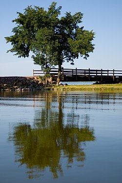
Lake Shetek
| Lake Shetek | |
|---|---|

Lake Shetek from Lake Shetek State Park
|
|
| Location | The Lakes, Murray County, Minnesota |
| Coordinates | 44°7′12″N 95°41′24″W / 44.12000°N 95.69000°WCoordinates: 44°7′12″N 95°41′24″W / 44.12000°N 95.69000°W |
| Type | Glacial lake |
| Primary outflows | West Fork of the Des Moines River |
| Basin countries | United States |
| Surface area | 3,596 acres (1,455 ha) |
| Max. depth | 10 feet (3.0 m) |
| Shore length1 | 31.7 miles (51.0 km) |
| Surface elevation | 1,483 feet (452 m) |
| Islands | Keeley, Loon, and Valhalla |
| Settlements | Currie, Minnesota |
| 1 Shore length is not a well-defined measure. | |
Lake Shetek is the largest lake in southwestern Minnesota, United States, and the headwaters of the Des Moines River. It is located in The Lakes, an unincorporated community in Murray County a few miles north-northwest of Currie. The name Shetek is derived from "pelican" in the Ojibwe language.
Since large lakes are rare in southwestern Minnesota and for some distance over the borders into Iowa and South Dakota, Lake Shetek is a significant regional draw for water recreation. Lake Shetek State Park lies on its eastern shore.
Lake Shetek covers 3,596 acres (1,455 ha) to a maximum depth of just 10 feet (3.0 m). This modest depth is wholly typical for the Prairie Pothole Region. The shoreline totals 31.7 miles (51.0 km), about 85% of which is in private development. The watershed-to-lake ratio is 23:1, with much of that watershed under cultivation.
Lake Shetek is by far the largest of Murray County's hundred or so lakes. The next largest is currently 1,176-acre (476 ha) Lake Sarah just to the northwest. Great Oasis Lake at 1,466 acres (593 ha) was once second-largest but was drained in the early 20th century for farmland.
It is the headwaters of the West Fork of the Des Moines River, considered the river's main fork. Lake Shetek contains three main islands: Valhalla, Keeley, and Loon Islands. Causeways connect the first two to the western shore, and another connects the third to the eastern shore. Shetek also connects to Bloody Lake Fremont Lake and Armstrong Slough.
Lake Shetek and the surrounding landscape of wetlands and rolling hills are the result of glaciation. The lake lies on the Altamont Moraine, a terminal moraine marking the farthest extent of an ice lobe during the Wisconsin glaciation. This most-recent glaciation deposited a very thick blanket of till over the area.
...
Wikipedia
