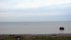
Lake Saint-Pierre
| Lake Saint Pierre (Lac Saint-Pierre) |
|
|---|---|

View on the lake from Pointe-du-Lac (a sector of Trois-Rivières)
|
|
| Location | Canada, Quebec |
| Coordinates | 46°12′15″N 72°49′56″W / 46.20417°N 72.83222°WCoordinates: 46°12′15″N 72°49′56″W / 46.20417°N 72.83222°W |
| Type | Natural |
| Primary inflows | Saint Lawrence River, Yamaska River, Saint-François River, Nicolet River, Maskinongé River, Rivière-du-Loup River and Yamachiche River |
| Primary outflows | Saint Lawrence River |
| Basin countries | Canada |
| Max. length | 32 km (20 mi) |
| Max. width | 14 km (9 mi) |
| Surface area | 353 km2 (136 sq mi) |
| Average depth | 3 m (9.8 ft) |
| Max. depth | 11.3 m (37 ft) |
| Surface elevation | 3.3 m (11 ft) |
| Islands | Sorel Islands |
| Settlements | Trois-Rivières, Berthierville |
| Designated | 27 May 1998 |
Lake Saint Pierre (French: Lac Saint-Pierre) is a lake in Quebec, Canada, a widening of the Saint Lawrence River between Sorel-Tracy and Trois-Rivières. It is located downstream, and northeast, of Montreal; and upstream, and southwest, of Quebec City. The end of the lake delimits the beginning of the St. Lawrence estuary.
This lake which is 32 kilometres (20 mi) long (excluding Sorel Islands) and 14 kilometres (8.7 mi) wide, is part of the St. Lawrence Seaway. Including its shoreline, islands, and wetlands, the lake is a nature reserve. The body of water is recognized as Ramsar site and as Biosphere Reserve, due to the presence of many marshes or wetlands that are frequented by waterfowl. Recreational activities on the river (such as fishing, boating, sailing, swimming, water skiing, nature observation) are active mainly in summer season. Sport fishing is particularly popular, including ice fishing, especially in the great bay of Pointe-du-Lac.
Approximately 12,500 years ago, the retreat of the glaciers at the end of the last ice age resulted in a vast basin filled by the Champlain Sea. This sea extended from the city of Quebec to the east, and covered the Lower Mauricie, the Lower Laurentians, the lower part of the Ottawa Valley, Lake Ontario on the western side, and Lake Champlain USA) on the South side. The outline of the Champlain Sea is marked by ancient sandy shores where sand pits have been exploited. The water level has dropped some 8,000 years ago. The surface area of the watershed is 990,000 km2 (380,000 sq mi) (equivalent to more than 60% of the surface area of Quebec). 58% of the catchment area is located in the United States, 28% in Ontario and only 14% in Quebec (2.5% in direct tributaries, 0.07% in the littoral zone). Lake Saint-Pierre is linked to 11 administrative regions, 58 RCMs and 654 municipalities.
...
Wikipedia
