Lake County, Michigan
| Lake County, Michigan | |
|---|---|
 Location in the U.S. state of Michigan |
|
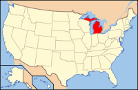
 Michigan's location in the U.S. |
|
| Founded | 1840, organized 1871. |
| Seat | Baldwin |
| Largest village | Baldwin |
| Area | |
| • Total | 574 sq mi (1,487 km2) |
| • Land | 567 sq mi (1,469 km2) |
| • Water | 6.9 sq mi (18 km2), 1.2% |
| Population | |
| • (2010) | 11,539 |
| • Density | 20/sq mi (8/km²) |
| Congressional district | 2nd |
| Time zone | Eastern: UTC-5/-4 |
| Website | www |
Lake County is a county located in the U.S. state of Michigan. As of the 2010 census, the population was 11,539. The county seat is Baldwin.
The county was created by the Michigan Legislature in 1840 as Aishcum County, then renamed Lake County in 1843, for its many lakes. It was administered by a succession of other Michigan counties prior to the organization of county government in 1871.
According to the U.S. Census Bureau, the county has a total area of 574 square miles (1,490 km2), of which 567 square miles (1,470 km2) is land and 6.9 square miles (18 km2) (1.2%) is water.
As of the census of 2000, there were 11,333 people, 4,704 households, and 3,052 families residing in the county. The population density was 20 people per square mile (8/km²). There were 13,498 housing units at an average density of 24 per square mile (9/km²). The racial makeup of the county was 84.66% White, 11.17% Black or African American, 1.01% Native American, 0.15% Asian, 0.04% Pacific Islander, 0.57% from other races, and 2.40% from two or more races. 1.69% of the population were Hispanic or Latino of any race. 20.2% were of English ancestry, 20.0% were of German ancestry, 8.4% were of Irish ancestry, and 6.1% were of Dutch ancestry according to 2010 American Community Survey estimates. 97.5% spoke English and 1.3% Spanish as their first language.
...
Wikipedia
