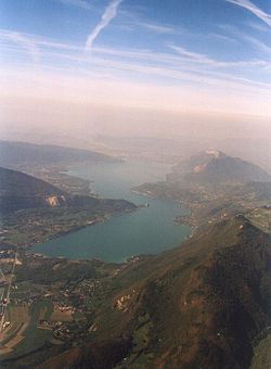
Lac d'Annecy
| Lake Annecy Lac d'Annecy |
|
|---|---|

With labels for towns and mountains
|
|
| Location | Haute-Savoie |
| Coordinates | 45°51′N 6°10′E / 45.850°N 6.167°ECoordinates: 45°51′N 6°10′E / 45.850°N 6.167°E |
| Primary inflows | Ire, Eau morte, Laudon, Bornette and Biolon |
| Primary outflows | Thiou |
| Catchment area | 251 km2 (97 sq mi) |
| Basin countries | France |
| Max. length | 14.6 km (9.1 mi) |
| Max. width | 3.2 km (2.0 mi) |
| Surface area | 27.59 km2 (10.65 sq mi) |
| Average depth | 41 m (135 ft) |
| Max. depth | 82 m (269 ft) |
| Water volume | 1,124.5 million cubic metres (911,600 acre·ft) |
| Residence time | 4 years |
| Surface elevation | 446.97 m (1,466.4 ft) |
| Settlements | Annecy (see list) |
Lake Annecy (French: Lac d'Annecy) is a perialpine lake in Haute-Savoie in France.
It is the third largest lake in France, after the Lac du Bourget and Lac de Grand-Lieu, if the French part of Lake Geneva (which is also partly in Switzerland) is excluded. It is known as "Europe's cleanest lake" because of strict environmental regulations introduced in the 1960s. It is a popular tourist destination known for its swimming and water sports.
The lake was formed about 18,000 years ago, at the time the large alpine glaciers melted. It is fed by many small rivers from the surrounding mountains (Ire, Eau morte, Laudon, Bornette and Biolon), and from a powerful underwater source, the Boubioz, which enters at 82 m depth.
A cycle path goes partially around Lake Annecy past Sevrier and St Jorioz to Ugine. It has an aim to reach Albertville. The lake is around 14 km long.
View of Lake Annecy from Talloires.
Paul Cézanne. Le lac bleu, 1896.
Lake Annecy, with the mountains of Dents de Lanfon, Lanfonnet and La Tournette in the background.
![]() This article incorporates text from a publication now in the public domain: Chisholm, Hugh, ed. (1911). "". Encyclopædia Britannica (11th ed.). Cambridge University Press.
This article incorporates text from a publication now in the public domain: Chisholm, Hugh, ed. (1911). "". Encyclopædia Britannica (11th ed.). Cambridge University Press.
...
Wikipedia
