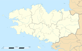
La Trinité-sur-Mer
|
La Trinité-sur-Mer An Drinded-Karnag |
||
|---|---|---|

La Trinité-sur-Mer
|
||
|
||
| Coordinates: 47°35′10″N 3°01′42″W / 47.5861°N 3.0283°WCoordinates: 47°35′10″N 3°01′42″W / 47.5861°N 3.0283°W | ||
| Country | France | |
| Region | Brittany | |
| Department | Morbihan | |
| Arrondissement | Lorient | |
| Canton | Quiberon | |
| Intercommunality | Côte des Mégalithes | |
| Government | ||
| • Mayor (2008—2014) | Yves Normand | |
| Area1 | 6.20 km2 (2.39 sq mi) | |
| Population (1999)2 | 1,530 | |
| • Density | 250/km2 (640/sq mi) | |
| Time zone | CET (UTC+1) | |
| • Summer (DST) | CEST (UTC+2) | |
| INSEE/Postal code | 56258 / 56470 | |
| Elevation | 0–31 m (0–102 ft) | |
|
1 French Land Register data, which excludes lakes, ponds, glaciers > 1 km² (0.386 sq mi or 247 acres) and river estuaries. 2Population without double counting: residents of multiple communes (e.g., students and military personnel) only counted once. |
||
1 French Land Register data, which excludes lakes, ponds, glaciers > 1 km² (0.386 sq mi or 247 acres) and river estuaries.
La Trinité-sur-Mer (An Drinded-Karnag in Breton), is a commune in the Morbihan department in Brittany, in north-western France.
It is located east of Carnac. The town is primarily a port, with a seaside quay dotted by numerous seafood restaurants. The town is also known for its watersport competitions.
Separated from the well known commune of Carnac in 1864, several of the famous neolithic standing stones in the Carnac stones fall within its boundaries, including the dolmens of Kerdeneven and Kermarquer, and the Petit-Ménec Alignments.
The Pont de Kerisper connects the commune to the neighbouring Saint-Philibert. The current bridge is a replacement, built in 1956, of the previous bridge which was destroyed by German bombing.
Inhabitants of La Trinité-sur-Mer are called Trinitains.
...
Wikipedia


