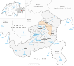
La Punt-Chamues-ch
| La Punt - Chamues-ch | ||
|---|---|---|
 |
||
|
||
| Coordinates: 46°34′N 9°55′E / 46.567°N 9.917°ECoordinates: 46°34′N 9°55′E / 46.567°N 9.917°E | ||
| Country | Switzerland | |
| Canton | Graubünden | |
| District | Maloja | |
| Area | ||
| • Total | 63.27 km2 (24.43 sq mi) | |
| Elevation | 1,687 m (5,535 ft) | |
| Population (Dec 2015) | ||
| • Total | 749 | |
| • Density | 12/km2 (31/sq mi) | |
| Postal code | 7522 | |
| SFOS number | 3785 | |
| Localities | La Punt, Chamues-ch | |
| Surrounded by | Bergün/Bravuogn, Bever, Madulain, Pontresina, Samedan, Zuoz | |
| Website |
www SFSO statistics |
|
La Punt - Chamues-ch (![]() [lɐˌpʊntˈtɕamuə̯ʃtɕ] ; Italian and official name until 1943: Ponte-Campovasto) is a municipality in the Maloja Region in the Swiss canton of Graubünden.
[lɐˌpʊntˈtɕamuə̯ʃtɕ] ; Italian and official name until 1943: Ponte-Campovasto) is a municipality in the Maloja Region in the Swiss canton of Graubünden.
La Punt-Chamues-ch is first mentioned around 1137-39 as Campolovasto. In 1244 it was mentioned as Ponte.
La Punt-Chamues-ch has an area, as of 2006[update], of 63.2 km2 (24.4 sq mi). Of this area, 33.2% is used for agricultural purposes, while 15.4% is forested. Of the rest of the land, 1.1% is settled (buildings or roads) and the remainder (50.4%) is non-productive (rivers, glaciers or mountains). Before 2017, the municipality was located in the Oberengadin sub-district of the Maloja district, after 2017 it was part of the Maloja Region. The municipality consists of two once separate towns, nowadays almost grown together. La Punt lies on the northern side of the valley, where the Albula pass ends. The railway line, with a station, and the main road - road 27 - also pass through La Punt, as does the Inn river. Chamues-ch (pronounced Tshamois-tsh), which lies on the southern side of the valley, at the end of the Val Chamuera valley and on the foot of the Piz Mezzaun.
Both towns feature hotels and some stores, while the buildings used by the municipality and fire department lie in between.
Until 1943 La Punt-Chamues-ch was known as by its Italian name of Ponte-Campovasto.
...
Wikipedia


