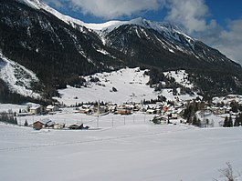
Bergün
| Bergün/Bravuogn | ||
|---|---|---|
 |
||
|
||
| Coordinates: 46°37′N 9°45′E / 46.617°N 9.750°ECoordinates: 46°37′N 9°45′E / 46.617°N 9.750°E | ||
| Country | Switzerland | |
| Canton | Graubünden | |
| District | Albula | |
| Area | ||
| • Total | 145.65 km2 (56.24 sq mi) | |
| Elevation | 1,367 m (4,485 ft) | |
| Population (Dec 2015) | ||
| • Total | 507 | |
| • Density | 3.5/km2 (9.0/sq mi) | |
| Postal code | 7482 | |
| SFOS number | 3521 | |
| Localities | Bergün, Latsch, Stuls, Preda | |
| Surrounded by | Bever, Davos, Filisur, La Punt-Chamues-ch, Samedan, S-chanf, Tinizong-Rona, Wiesen, Zuoz | |
| Twin towns | Hallau (Switzerland) | |
| Website |
www SFSO statistics |
|
Bergün/Bravuogn (German: Bergün, Romansh: ![]() Bravuogn , in the local Romansh dialect Brauégn) is a municipality in the district of Albula in the canton of Graubünden in Switzerland. The double name (German/Romansh) has been the official name since 1943.
Bravuogn , in the local Romansh dialect Brauégn) is a municipality in the district of Albula in the canton of Graubünden in Switzerland. The double name (German/Romansh) has been the official name since 1943.
Bergün/Bravuogn is first mentioned in 1209 as de Bregonio.
Bergün/Bravuogn has an area, as of 2006[update], of 145.6 km2 (56.2 sq mi). Of this area, 21.4% is used for agricultural purposes, while 20.4% is forested. Of the rest of the land, 0.8% is settled (buildings or roads) and the remainder (57.5%) is non-productive (rivers, glaciers or mountains).
The municipality is located in the Bergün sub-district of the Albula district. It is located on the Albula river and along the Albula pass road.
It consists of the linear village of Bergün/Bravuogn and the settlements of Latsch (on the right side terrace above the river) and Stugl/Stuls. Latsch joined the municipality in 1912 and Stugl/Stuls joined in 1920. From Stugl/Stuls towards Albula pass the settlement of Preda can be found which became a temporary village when the Albula railway tunnel was built between 1898 and 1903. Lai da Palpuogna, a mountain lake, is located between Preda and Albula Pass. Until 1943 Bergün/Bravuogn was known as Bergün.
...
Wikipedia


