La Fève
|
Merhavia מֶרְחַבְיָה |
|
|---|---|
| Hebrew transcription(s) | |
| • standard | Merhavya |
| Coordinates: 32°36′21″N 35°18′26″E / 32.60583°N 35.30722°ECoordinates: 32°36′21″N 35°18′26″E / 32.60583°N 35.30722°E | |
| Grid position | 179/223 PAL |
| District | Northern |
| Council | Jezreel Valley |
| Affiliation | Kibbutz Movement |
| Founded | 1929 |
| Founded by | Galician Hashomer Hatzair members |
| Population (2015) | 1,136 |
| Website | www.merchavia.org.il |
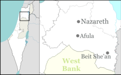
Merhavia (Hebrew: מֶרְחַבְיָה, lit. Great Enlargement – God) is a kibbutz in northern Israel. Located to the east of Afula, it falls under the jurisdiction of Jezreel Valley Regional Council. In 2015 it had a population of 1,136.
The name Merhavia is derived from the Book of Psalms 118:5;
Out of my straits I called upon the LORD; .. answered me with great enlargement – God.
In the metaphorical sense: "God set me free" - the experience of the Jews immigrating to the Land of Israel and achieving a new homeland without the straits of persecution.
The place was earlier named in Arabic al-Fuleh ("The beans"), also rendered as El Fuleh, al-Fula etc. It was possibly the place called Alpha in the list of Thutmes III.
In the Crusader era it was known as la Feve or Castrum Fabe. It had a Templar castle (first mentioned in 1169/72), of which just some mounds remain. The area was under Crusader control between 1099 and 1187. In 1183 the Battle of Al-Fule took place here, between the Crusaders and the forces of Saladin.
In 1226, Syrian geographer Yaqut al-Hamawi mentioned it as being "a town in Jund Filastin," and formerly a Crusader castle between Zir'in and Nazareth. The area was again under Crusader control between 1240/1 and 1263.
The Survey of Western Palestine (SWP) noted a ruined church about 200 meters SSE of the castle, which probably was the remains of the Crusader parish church. However, these remains were destroyed in 1939-1940.
...
Wikipedia

