La Costa xeric shrublands
| La Costa xeric shrublands (NT1309) | |
|---|---|

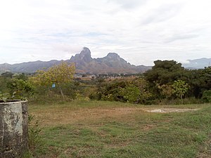
Morros of San Juan de los Morros
|
|
| Ecology | |
| Realm | Neotropical |
| Biome | Deserts and xeric shrublands |
| Geography | |
| Area | 68,375 km2 (26,400 sq mi) |
| Countries | Venezuela |
| Coordinates | 9°23′10″N 65°56′38″W / 9.386°N 65.944°WCoordinates: 9°23′10″N 65°56′38″W / 9.386°N 65.944°W |
| Climate type | Aw: equatorial, winter dry |
The La Costa xeric shrublands (NT1309) is an ecoregion in Venezuela that stretches along the Caribbean coast. The dry scrub and savanna has been subject to modification since the 16th century by European colonists who replaced it by a patchwork of farm fields and pasturage. Little of the original habitat remains.
The La Costa xeric shrublands ecoregion extends along Venezuela's Caribbean coast, covering plains, hills and isolated mountains. Caracas, the capital of Venezuela, lies partly in this ecoregion. It reaches from Sucre state in the east to Yaracuy state in the west. The ecoregion includes areas of savanna, dry forest, moist forest, swamp and scrub. It has an area of 6,837,568 hectares (16,896,000 acres).
In the west the shrubland transitions into the Lara-Falcón dry forests ecoregion. The extreme west of the La Costa xeric shrublands merges into the Paraguana xeric scrub just east of Barquisimeto. To the south the La Costa xeric shrublands transitions into the Llanos. There are regions of Cordillera de la Costa montane forests along the Caribbean coastline. The coastal area in the east of the region is covered by Araya and Paria xeric scrub. In the extreme east the ecoregion transitions into Orinoco Delta swamp forests.
The xeric shrublands are in the Coastal Cordillera geographical region. The shrublands, which blend into the Llanos grasslands to the south, surround the mountains of the Venezuelan Coastal Range. Elevations rise from sea level to 1,000 metres (3,300 ft) in the upper foothills of the mountains. Along the coast there are sandy beaches, mangroves, lagoons and hilly patches of moist forest.
Average annual temperature is around 20 °C (68 °F). Annual rainfall is 300–1,000 millimetres (12–39 in). At a sample location at coordinates 9°45′N 66°15′W / 9.75°N 66.25°W the Köppen climate classification is "Aw": equatorial, winter dry. At this location the mean temperature varies from 24.5 °C (76.1 °F) in July to 26.5 °C (79.7 °F) in April. Total yearly rainfall is about 1,400 millimetres (55 in). Monthly rainfall varies from 12.5 millimetres (0.49 in) in March to 233.1 millimetres (9.18 in) in July.
...
Wikipedia
