L'Île-du-Grand-Calumet, Quebec
| L'Île-du-Grand-Calumet | |
|---|---|
| Municipality | |
 |
|
 Location within Pontiac RCM |
|
| Location in western Quebec | |
| Coordinates: 45°43′N 76°37′W / 45.72°N 76.62°WCoordinates: 45°43′N 76°37′W / 45.72°N 76.62°W | |
| Country |
|
| Province |
|
| Region | Outaouais |
| RCM | Pontiac |
| Settled | 1840s |
| Constituted | July 1, 1855 |
| Government | |
| • Mayor | Paul-Émile Maleau |
| • Federal riding | Pontiac |
| • Prov. riding | Pontiac |
| Area | |
| • Total | 147.40 km2 (56.91 sq mi) |
| • Land | 132.14 km2 (51.02 sq mi) |
| Population (2011) | |
| • Total | 731 |
| • Density | 5.5/km2 (14/sq mi) |
| • Pop 2006-2011 |
|
| • Dwellings | 428 |
| Time zone | EST (UTC−5) |
| • Summer (DST) | EDT (UTC−4) |
| Postal code(s) | J0X 1J0 |
| Area code(s) | 819 |
| Highways | No major routes |
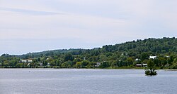
L'Île-du-Grand-Calumet is a municipality in the Outaouais region, part of the Pontiac Regional County Municipality, Quebec, Canada. The municipality consists primarily of Calumet Island (also Grand Calumet Island; in French Île du Grand Calumet), but also includes Lafontaine Island, French Island, Green Island, and numerous minor islets, all in the Ottawa River, approximately two kilometres from Campbell's Bay, two kilometres from Bryson.
Before December 22, 2007, it was called simply Grand-Calumet. The official name was changed to L'Île-de-Grand-Calumet, however, on July 5, 2008, it was changed again to use -du- rather than -de-. This last modification was considered a correction rather than a name change.
Grand-Calumet is the principal area of L'Île-du-Grand-Calumet. Its centre is Sainte-Anne Church, which is alongside the municipal building and the school. It is also the site where First Nation tribes held their annual pow-wow, and where they smoke occasionally their Grand-Calumet.
Its name is a reference to the ceremonial pipe occasionally smoked by the tribes of the first nation people to settle mainly territory disputes (establishing which tribe had the right to fish and hunt in a certain area). They gathered at Grand-Calumet in large numbers for their friendly annual pow-wow and exchanging stuff.
Bordering on Whitewater Region, Ontario, the municipality is the co-location of some of the roughest sections on the Ottawa River, popular with kayakers and rafters. Three whitewater rafting companies based in L'Île-du-Grand-Calumet take adventurers down the Rocher Fendu Rapids, known as the best whitewater rapids in Eastern North America.
About 20 kilometers (12 mi) long by 7 kilometers (4.3 mi) wide, L'Île-du-Grand-Calumet has an elevation of no more than 200 meters (660 ft) above sea level. Agricultural land use is mostly concentrated in the centre of the island.
The population centre is mainly Grand-Calumet; other smaller centres are Rivière-Barry, Tancredia, Dunraven, Freshwater, Duffyville.
...
Wikipedia

