Kreševo
|
Kreševo Крешево |
|
|---|---|
| Municipality and town | |

Town of Kreševo panorama
|
|
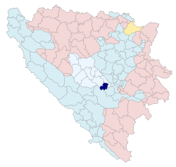
 Location of Kreševo in Bosnia and Herzegovina |
|
| Location of Kreševo in Bosnia and Herzegovina | |
| Coordinates: 43°51′56.22″N 18°02′04.52″E / 43.8656167°N 18.0345889°ECoordinates: 43°51′56.22″N 18°02′04.52″E / 43.8656167°N 18.0345889°E | |
| Country | Bosnia and Herzegovina |
| Entity | Federation of Bosnia and Herzegovina |
| Canton | Central Bosnia |
| Government | |
| • Mayor | Radoje Vidović (HDZ BiH) |
| Area | |
| • Total | 149 km2 (58 sq mi) |
| • Land | 149 km2 (58 sq mi) |
| • Water | 0 km2 (0 sq mi) |
| Elevation | 640 m (2,100 ft) |
| Population (2013) | |
| • Total | 5,638 |
| • Density | 38/km2 (98/sq mi) |
| Time zone | CET (UTC+1) |
| • Summer (DST) | CEST (UTC+2) |
| Post code | 71260 |
| Area code | +387 030 |
| Website | www |
|
|
|
|
|
|
|
|
|
|
|
|
|
|---|---|---|---|---|---|---|---|---|---|---|---|
| 1961 |
|
|
|
|
|
|
|
|
|
|
|
| 1971 |
|
|
|
|
|
|
|
|
|
|
|
| 1981 |
|
|
|
|
|
|
|
|
|
|
|
| 1991 |
|
|
|
|
|
|
|
|
|
|
|
| 2013 |
|
|
|
|
|
|
|
|
|
|
|
|
Municipal Council of Kreševo Općinsko vijeće Kreševo |
|
|---|---|
| Type | |
| Type | |
| Leadership | |
|
Chairman
|
Mirsad Beganović, SDA
|
| Structure | |
| Seats | 15 council members |
|
6 / 15
|
|
|
3 / 15
|
|
|
2 / 15
|
|
|
1 / 15
|
|
|
1 / 15
|
|
|
1 / 15
|
|
| Elections | |
|
Last election
|
7 October 2012 |
Kreševo (Croatian pronunciation: [krêʃeʋo]) is a town and municipality in Bosnia and Herzegovina. It is located in the Central Bosnia Canton, a unit of the Federation of Bosnia and Herzegovina. Kreševo is a mountainous town, located in a narrow valley of the Kreševica river on the slope of Mount Bitovnje.
The area of Kreševo was inhabited since the Neolithic. Various material remains are indicating that a life in Kreševo was intensified during the Roman Empire, when the municipality was part of the Roman province of Illyrcicum, as well as during the Migration Period. Reason for this are the subsoil assets of the Kreševo Municipality area, where gold, silver, copper, iron and mercury where exploited.
A number of the Roman aqueducts can be found on the area of the Kreševo Municipality, as well as remains of the Roman settlement near the village of Zid. During the destruction of the old Kreševan church in 1964, a number of the romanesque capitals were found in its walls from the period of 11th and 12th century. A Roman epigraphic monument was also found, in which an anonymous Roman municipium is mentioned. During the Roman period, there were two connection roads to the Via Argentaria, one of them led to an area near Sarajevo, and the other led towards the Visoko area.
The largest development of the Kreševo area occurred during the period of the Bosnian Kingdom. The first written mention of Kreševan silver, copper and lead mines dates to 1381. When the Saxons arrived in Bosnia, the technology of extracting and ore processing was significantly developed. They brought legal norms called the "Saxons' laws" and the modern technology. However, the biggest rise of the Kreševo area occurred when it become one of the seats of the Bosnian kings. The first mentioning of the town of Kreševo was in a charter of King Stephen Thomas from 12 August 1434. The King mentioned Kreševo as a "royal town of Kreševo". During that time, the Kingdom of Bosnia had an intensive cooperation with the Republic of Ragusa. On 3 September 1444, King Stephen Thomas approved trade privileges to the Ragusans in Kreševo.
...
Wikipedia

