
Krautheim (Jagst)
| Krautheim | ||
|---|---|---|
|
||

Krautheim
|
||
|
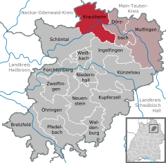
Location of Krautheim within Hohenlohekreis district
  |
||
| Coordinates: 49°23′N 9°38′E / 49.383°N 9.633°ECoordinates: 49°23′N 9°38′E / 49.383°N 9.633°E | ||
| Country | Germany | |
| State | Baden-Württemberg | |
| Admin. region | Stuttgart | |
| District | Hohenlohekreis | |
| Municipal assoc. | Krautheim | |
| Government | ||
| • Mayor | Andreas Köhler | |
| Area | ||
| • Total | 52.91 km2 (20.43 sq mi) | |
| Elevation | 298 m (978 ft) | |
| Population (2015-12-31) | ||
| • Total | 4,542 | |
| • Density | 86/km2 (220/sq mi) | |
| Time zone | CET/CEST (UTC+1/+2) | |
| Postal codes | 74238 | |
| Dialling codes | 06294 | |
| Vehicle registration | KÜN | |
| Website | www.krautheim.de | |

Krautheim is a town in the Hohenlohe district of Baden-Württemberg, in south central Germany. It is situated on the river Jagst, 12 km (8 mi) northwest of Künzelsau, and 16 km (10 mi) southwest of Bad Mergentheim. The town lies in the border area between the Baden and Württemberg regions. Records from the year 1096 mention the area as "Crutheim", but the modern incorporation was approved during 1972-73.
Krautheim is located at the northernmost point of the Jagst river, at elevation 210–420 metres (690–1,380 ft), in southern Germany. The Jagst river, in this area, has dug 130–150 m deep (430–490 ft) into the limestone terrain of the Hoheloher Ebene. Characteristic of Krautheim is the view of the same castle visible from afar, which offers a 17 m high and up to 2.70 m thick shield wall (55.8 ft × 8.9 ft), as an impressive sight. The massive castle keep, with its height of 30 metres (98 ft), gives a comprehensive view into the Jagst valley and the surrounding landscape.
The current city of Krautheim is the result of administrative reform during 1972/1973. At the time, there was a merger of the formerly independent municipalities of Baden Krautheim, Gommersdorf, Horrenbach, Klepsau, Neunstetten, Oberndorf and the Württemberg-based communities of Altkrautheim, Ober- und Unterginsbach together. The area was named as the city of Krautheim. The towns have a range between about 60 and 700 inhabitants, and Krautheim itself as the central town has about 2,000 inhabitants.
Among the former municipalities, Altkrautheim, Gommersdorf, Horrenbach, Klepsau, Krautheim, Oberginsbach and Unterginsbach only belong the localities of the same name. The former municipality Neunstetten includes the village Neunstetten und the subdivisions Ölmühle und Untere Mühle. The former municipality Oberndorf includes the village of Oberndorf and the subdivisions of Knock (Kapellenberg) und Stockbrunnenwiesen.
Many sections have changed their names from the former villages. In the urban area of Krautheim are the municipalities of Stein, Windberg and Zimmerbach in the area of former Gommersdorf, Dacht in the area of the former Horrenbach, Nydelingen, Pichintal and Wellendorf in the area of Krautheim before the reform, Obererlenbach in the area of the former Neunstetten, Remenweiler in the area of the former Oberginsbach, and Mutzenbrunn in the area of the former community Oberndorf.
...
Wikipedia