Krasnoslobodsk, Republic of Mordovia
| Krasnoslobodsk (English) Краснослободск (Russian) Ош (Moksha) |
|
|---|---|
| - Town - | |
 Location of the Republic of Mordovia in Russia |
|
|
|
|
|
|
|
|
|
|
| Administrative status (as of September 2014) | |
| Country | Russia |
| Federal subject | Republic of Mordovia |
| Administrative district | Krasnoslobodsky District |
| Town of district significance | Krasnoslobodsk |
| Administrative center of | Krasnoslobodsky District, town of district significance of Krasnoslobodsk |
| Municipal status (as of September 2011) | |
| Municipal district | Krasnoslobodsky Municipal District |
| Urban settlement | Krasnoslobodskoye Urban Settlement |
| Administrative center of | Krasnoslobodsky Municipal District, Krasnoslobodskoye Urban Settlement |
| Statistics | |
| Population (2010 Census) | 10,151 inhabitants |
| Time zone | MSK (UTC+03:00) |
| Known since | 1571 |
| Town status since | 1780 |
| Postal code(s) | 431260, 431261, 431289 |
| on | |
| 2010 Census | 10,151 |
|---|---|
| 2002 Census | 10,843 |
| 1989 Census | 11,261 |
| 1979 Census | 10,099 |
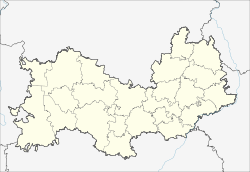
Krasnoslobodsk (Russian: Краснослобо́дск; Moksha: Ош) is a town and the administrative center of Krasnoslobodsky District of the Republic of Mordovia, Russia, located on the left bank of the Moksha River (a tributary of the Oka), 107 kilometers (66 mi) west of Saransk, the capital of the republic. As of the 2010 Census, its population was 10,151.
It has been known since 1571; town status was granted to it in 1780.
Within the framework of administrative divisions, Krasnoslobodsk serves as the administrative center of Krasnoslobodsky District. As an administrative division, it is incorporated within Krasnoslobodsky District as the town of district significance of Krasnoslobodsk. As a municipal division, the town of district significance of Krasnoslobodsk is incorporated within Krasnoslobodsky Municipal District as Krasnoslobodskoye Urban Settlement.
...
Wikipedia


