Kraljevo, Serbia
|
Kraljevo Град Краљево |
||||
|---|---|---|---|---|
| City | ||||
| City of Kraljevo | ||||
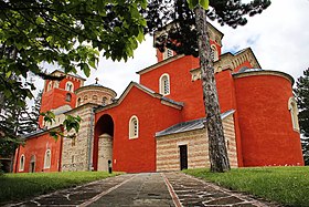
From top: City center square, Žiča Monastery
|
||||
|
||||
 Location of the city of Kraljevo within Serbia |
||||
| Coordinates: 43°43′25″N 20°41′15″E / 43.72361°N 20.68750°ECoordinates: 43°43′25″N 20°41′15″E / 43.72361°N 20.68750°E | ||||
| Country |
|
|||
| Region | Šumadija and Western Serbia | |||
| District | Raška | |||
| Settlements | 92 | |||
| Government | ||||
| • Mayor | Tomislav Ilić (SNS) | |||
| Area | ||||
| Area rank | 1st | |||
| • Administrative | 1,530 km2 (590 sq mi) | |||
| Elevation | 192 m (630 ft) | |||
| Population (2011 census) | ||||
| • Rank | 9th | |||
| • Urban | 68,749 | |||
| • Administrative | 125,488 | |||
| • Administrative density | 82.02/km2 (212.4/sq mi) | |||
| Time zone | CET (UTC+1) | |||
| • Summer (DST) | CEST (UTC+2) | |||
| Postal code | 36000 | |||
| Area code | +381(0)36 | |||
| ISO 3166 code | SRB | |||
| Car plates | KV | |||
| Website | www |
|||
Kraljevo (Serbian Cyrillic: Краљево; [krǎːʎɛʋɔ]) is a city and the administrative center of the Raška District in western Serbia. Built beside the river Ibar, 7 kilometres (4 miles) west of its confluence with the Western Morava, it is located in the midst of an upland valley, between the mountains of Kotlenik in the north, and Stolovi in the south.
In 2011 the city urban area has a population of 68,749 inhabitants, while the city administrative area has 125,488 inhabitants. The city administrative area consists of 16 settlements. With an area of 1530 km², it is the largest municipality in Serbia.
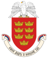
Formerly known as Rudo Polje (Рудо Поље), Karanovac (Карановац) and Rankovićevo (Ранковићево), Kraljevo received its present name, meaning "the King's Town", from King Milan I of Serbia and from all six other kings that had been crowned in that area. The coat of arms of Kraljevo simbolizes those seven kings with the seven crowns drawn on it.
The "lower" Ibar region is thought to be the first area where Serbs began to develop cultural, political and economic life. The Serbian state named Raška was formed in the 11th century and the most active part of this state was in the area of today's Kraljevo. There are numerous monasteries in the area, of which Studenica (1188), Žiča (1219) are examples. These provided a seat for the Archbishop and have been used for the crowning of seven Serbian kings, e.g. Ljubostinja, Gradac, Stara and Pavlica. There is also a medieval fortress known as Maglič.
...
Wikipedia


