Kotelnich
| Kotelnich (in English) Котельнич (Russian) Кäкшäр (Mari) |
|
|---|---|
| - Town - | |
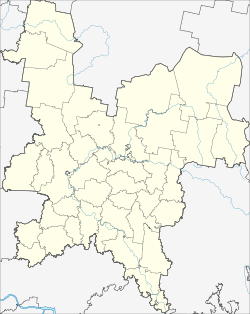
 Location of Kirov Oblast in Russia |
|
|
|
|
|
|
|
|
|
|
| Administrative status (as of April 2008) | |
| Country | Russia |
| Federal subject | Kirov Oblast |
| Administratively subordinated to | Town of Kotelnich |
| Administrative center of | Kotelnichsky District, Town of Kotelnich |
| Municipal status (as of April 2012) | |
| Urban okrug | Kotelnich Urban Okrug |
| Administrative center of | Kotelnich Urban Okrug, Kotelnichsky Municipal District |
| Statistics | |
| Population (2010 Census) | 24,979 inhabitants |
| Time zone | MSK (UTC+03:00) |
| First mentioned | 1143 |
| Town status since | 1780 |
| Previous names | Koksharov (until 1182) |
| on | |
Kotelnich (Russian: Коте́льнич; Mari: Кäкшäр) is a river port town in Kirov Oblast, Russia, located on the right bank of the Vyatka River near its confluence with the Moloma, along the route of the Trans-Siberian Railway, 124 kilometers (77 mi) southwest of Kirov. Population: 24,979 (2010 Census);28,245 (2002 Census);36,841 (1989 Census).
The locality of Koksharov (Кокшаров) was first mentioned in 1143 as a Mari town. In 1182, it was occupied by Russians and renamed Kotelnich, from the word kotel (now kotlovina), meaning "hollow", "depression". Town status was granted to it in 1780.
The city of Kotelnich is well known all over Russia and in some foreign countries due to location of ancient fossil vertebrates – Pareiasaurus.
Pareiasaurus – is a large reptile with spurs in the buccal region of the skull. These animals grew to about 3 meters long and inhabited Europe, South Africa, and Asia 250-260 million years ago.
This landmark is located on the right steep bank of the Vyatka River and covers 30 km from Kotelnich to Vishkil.
The best view on the landmark opens to the passengers of the train going across Vyatka near Kotelnich.
The first excavation works were performed in 1933, then in 1948 and 1949. Full-scale research started in the late 80’s-early 90’s. Specialists prove the uniqueness of the landmark, the only comparable sight being Karoo, South Africa.
...
Wikipedia


