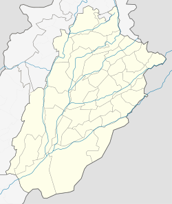
Kot Addu City
|
Kot Addu كوٹ ادُّو |
|
|---|---|
| City | |
| Coordinates: 30°27′59″N 70°57′56″E / 30.46639°N 70.96556°ECoordinates: 30°27′59″N 70°57′56″E / 30.46639°N 70.96556°E | |
| Country | Pakistan |
| Province | Punjab |
| District | Muzaffargarh District |
| Time zone | PST (UTC+5) |
Kot Addu is a city and tehsil in the Muzaffargarh District of the southern part of the Punjab province of Pakistan. This city is subdivided into 30 Union Councils and has a population of over 400,000, making it the 150th largest city in Pakistan. It is located just east of the Indus River, about 866 km (538 mi) from Karachi, 600 km (370 mi) from Islamabad, 100 km from Multan, 80 km from D.G.Khan, 60 km (37 mi) from Muzaffargarh, 60 km from Layyah, and 16 km (9.9 mi) from Taunsa Barrage. Kot Addu City attracts a large number of tourists every year, due to the Indus river and public gardens among other things. The city is served by Kot Addu Junction railway station.The Zip code of Kot Addu is 34050.
The city contains a total of 31 Union councils, which are listed below.
The city of Kot Addu is located in the southern area of Punjab province, almost at the exact center of Pakistan. The area around the city is a flat plain and is ideal for agriculture. There are two main canals (Muzaffar, and T.P. link) and eight sub-canals that cross Kot Addu, providing water from the Indus River. The geographical coordinates of the city, according to Google Maps, are: N 30° 28' 34" E 70° 57' 52".
Kot Addu is located almost exactly at the geographical center of Pakistan. The closest major city is Multan. The area around the city is a flat alluvial plain and is ideal for agriculture, with many citrus and mango farms. There are also canals that cut across the Muzaffargarh District, providing water to farms. During the monsoon season, the land close to the Taunsa Barrage is usually flooded.
...
Wikipedia


