Kosse, TX
| Kosse, Texas | |
|---|---|
| Town | |

Kosse City Office
|
|
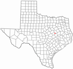
 Location of Kosse, Texas |
|
 |
|
| Coordinates: 31°18′27″N 96°37′49″W / 31.30750°N 96.63028°WCoordinates: 31°18′27″N 96°37′49″W / 31.30750°N 96.63028°W | |
| Country | United States |
| State | Texas |
| County | Limestone |
| Area | |
| • Total | 1.3 sq mi (3.4 km2) |
| • Land | 1.3 sq mi (3.4 km2) |
| • Water | 0.0 sq mi (0.0 km2) |
| Elevation | 499 ft (152 m) |
| Population (2000) | |
| • Total | 497 |
| • Density | 381.7/sq mi (147.4/km2) |
| Time zone | Central (CST) (UTC-6) |
| • Summer (DST) | CDT (UTC-5) |
| ZIP code | 76653 |
| Area code(s) | 254 |
| FIPS code | 48-39844 |
| GNIS feature ID | 1360753 |
Kosse is a town in Limestone County, Texas, United States. The population was 497 at the 2000 census. A July 1, 2009 U.S. Census Bureau estimate placed the population at 507.
Kosse calls itself "A Little Town with a Big Heart."
Kosse is located at 31°18′27″N 96°37′49″W / 31.30750°N 96.63028°W (31.307452, -96.630267). It is situated at the junction of State Highways 7 and 14 in southwestern Limestone County, approximately 16 miles east of Marlin and 17 miles south of Groesbeck. The closest large cities are Waco, 42 miles to the northwest, and Bryan/College Station, 52 miles south of Kosse.
According to the United States Census Bureau, the town has a total area of 1.3 square miles (3.4 km2), all land.
Initial settlement of the area dates back to the mid 1840s. Settlers built homes near Duck Creek and ran a stage stop for the Franklin-Springfield and Waco-Marlin stage routes. Following the Civil War, the area was chosen as the destination for the Houston and Texas Central Railway (H&TC). The community that sprang up around the site was named Kosse, after H&TC chief engineer Theodore Kosse. Eutaw, a much larger settlement two miles east of Kosse, began to decline when the railroad bypassed the community in favor of its smaller neighbor. Businesses and residents followed. The post office moved from Eutaw to Kosse in 1870. In 1871, the town of Kosse was chartered and a municipal government was organized. By 1880, the town had a population of 476 and four churches. Five years later, Kosse had multiple cotton gins, two sawmills, and three gristmills. An acre of land was granted for the construction of a public school on October 1, 1884. Kosse became an independent school district in 1893, with J. Thomas Hall as its first superintendent. The district had a total of 225 students. A separate school with 80 students and two teachers served the area's black community. By 1890 there were 647 residents. Kosse was home to 700 residents in 1914. A local Chamber of Commerce was formed in 1921. The Great Depression severely impacted Kosse as businesses closed and people left in search of greater employment opportunities. Declining student enrollment caused the Kosse School Board to vote in favor of consolidation with Groesbeck in 1968. Kosse had eleven businesses in 1989. The 1990 census put the number of inhabitants at 505. That figure had dropped to 497 in 2000.
...
Wikipedia
