Kolomyia Raion
|
Kolomyia Raion Коломийський район |
|||
|---|---|---|---|
| Raion | |||
|
|||
 |
|||
| Coordinates: 48°35′10″N 24°59′32″E / 48.58611°N 24.99222°ECoordinates: 48°35′10″N 24°59′32″E / 48.58611°N 24.99222°E | |||
| Country |
|
||
| Region | Ivano-Frankivsk Oblast | ||
| Established | ? | ||
| Admin. center | Kolomyia | ||
| Subdivisions |
List
|
||
| Government | |||
| • Governor | Mykhailo Vintoniak | ||
| Area | |||
| • Total | 1,026 km2 (396 sq mi) | ||
| Population | |||
| • Total | 99,447 | ||
| • Density | 97/km2 (250/sq mi) | ||
| Time zone | EET (UTC+2) | ||
| • Summer (DST) | EEST (UTC+3) | ||
| Postal index | 285800 | ||
| Area code | 380 | ||
| Website | [?] | ||
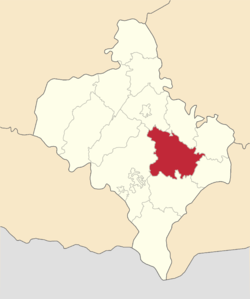
Kolomyia Raion (Ukrainian: Коломийський район) is a raion (district) of Ivano-Frankivsk Oblast (region). The city of Kolomyia is the administrative center of the raion, but administratively the city is incorporated as city of oblast significance and is directly subordinated to the oblast administration. The raion has three urbanized towns and couple of small villages beside numerous other villages. Population: 99,447 (2016 est.).
...
Wikipedia


