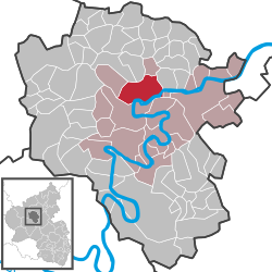
Klotten
| Klotten | ||
|---|---|---|
|
||
| Coordinates: 50°10′00″N 7°11′59″E / 50.16667°N 7.19972°ECoordinates: 50°10′00″N 7°11′59″E / 50.16667°N 7.19972°E | ||
| Country | Germany | |
| State | Rhineland-Palatinate | |
| District | Cochem-Zell | |
| Municipal assoc. | Cochem | |
| Government | ||
| • Mayor | Hans-Gerd Loosen | |
| Area | ||
| • Total | 16.07 km2 (6.20 sq mi) | |
| Elevation | 110 m (360 ft) | |
| Population (2015-12-31) | ||
| • Total | 1,233 | |
| • Density | 77/km2 (200/sq mi) | |
| Time zone | CET/CEST (UTC+1/+2) | |
| Postal codes | 56818 | |
| Dialling codes | 02671 | |
| Vehicle registration | COC | |
Klotten is a winemaking centre and an Ortsgemeinde – a municipality belonging to a Verbandsgemeinde, a kind of collective municipality – in the Cochem-Zell district in Rhineland-Palatinate, Germany. It belongs to the Verbandsgemeinde of Cochem, whose seat is in the like-named town.
The municipality lies on the river Moselle and is surrounded by steep slate slopes. Vineyards in Klotten include Burg Coraidelstein, Brauneberg and Rosenberg.
In 698, Klotten had its first documentary mention. The Polish queen Richeza, Count Palatine Ezzo’s daughter and Emperor Otto II’s granddaughter, quite probably stayed with her three children between 1040 and 1049 in Klotten, where she had herself built a chapel (Nikolauskirche, or Saint Nicholas’s Church) and a dwelling tower, which was linked by a bridge to the chapel. Upon her death on 21 March 1063, she bequeathed all that she owned to the Brauweiler Benedictine Abbey near Cologne. Her sarcophagus stands today in Cologne Cathedral, to the left below the High Altar, the “Epiphany Shrine”.
Electoral-Trier overlordship ended with the French Revolutionary occupation of the Rhine’s left bank between 1794 and 1796. In 1814 Klotten was assigned to the Kingdom of Prussia at the Congress of Vienna. Since 1946, it has been part of the then newly founded state of Rhineland-Palatinate.
...
Wikipedia


