Kitchener—Conestoga
|
|
|||
|---|---|---|---|

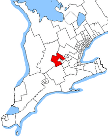
Kitchener—Conestoga in relation to Southern Ontario ridings
|
|||
| Federal electoral district | |||
| Legislature | House of Commons | ||
| MP |
Conservative |
||
| District created | 2003 | ||
| First contested | 2004 | ||
| Last contested | 2015 | ||
| District webpage | profile, map | ||
| Demographics | |||
| Population (2011) | 93,827 | ||
| Electors (2015) | 67,890 | ||
| Area (km²) | 949 | ||
| Pop. density (per km²) | 98.9 | ||
| Census divisions | Waterloo | ||
| Census subdivisions | Kitchener, Wellesley, Wilmot, Woolwich | ||
Kitchener—Conestoga (formerly known as Kitchener—Wilmot—Wellesley—Woolwich) is a federal electoral district in Ontario, Canada, that has been represented in the Canadian House of Commons since 2004. Its population in 2006 was 114,405.
The district includes the townships of Woolwich, Wellesley and Wilmot, and the southwestern part of the City of Kitchener, i.e., the part of the City of Kitchener lying south of a line (from west to east) Conestoga Parkway, King Street East, the King Street Bypass and the Grand River.
The electoral district was created in 2003 from Waterloo—Wellington, part of Kitchener Centre, and part of Cambridge. It was known as "Kitchener—Wilmot—Wellesley—Woolwich" from 2004 to 2005.
This riding lost almost half of its territory to Kitchener South—Hespeler but gained territory from Kitchener Centre, Kitchener—Waterloo and a fraction from Wellington—Halton Hills during the 2012 electoral redistribution.
...
Wikipedia
