Kisarazu
|
Kisarazu 木更津市 |
|||
|---|---|---|---|
| City | |||

Center of Kisarazu
|
|||
|
|||
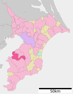
 Location of Kisarazu in Chiba Prefecture |
|||
| Coordinates: 35°22′33.5″N 139°55′0.6″E / 35.375972°N 139.916833°ECoordinates: 35°22′33.5″N 139°55′0.6″E / 35.375972°N 139.916833°E | |||
| Country | Japan | ||
| Region | Kantō | ||
| Prefecture | Chiba Prefecture | ||
| Government | |||
| • Mayor | Isao Mizukoshi (since April 2002) | ||
| Area | |||
| • Total | 138.95 km2 (53.65 sq mi) | ||
| Population (February 2016) | |||
| • Total | 134,239 | ||
| • Density | 966/km2 (2,500/sq mi) | ||
| Time zone | Japan Standard Time (UTC+9) | ||
| - Tree | Camellia | ||
| - Flower | Satsuki azalea | ||
| Phone number | 0438-23-7111 | ||
| Address | 1-1 Shiomi, Kisarazu-shi, Chiba-ken 292-8501 | ||
| Website | Official website | ||
Kisarazu (木更津市 Kisarazu-shi?) is a city located in Chiba Prefecture, in the Kantō region of Japan. As of February 2016, the city had an estimated population of 134,239 and a population density of 966 persons per km². The total area was 138.95 square kilometres (53.65 sq mi).
Kisarazu is located in the western part of the Bōsō Peninsula. The Tokyo Bay Aqua-Line, a bridge-tunnel across Tokyo Bay, connects Kisarazu and the cities of Kawasaki and Yokohama in Kanagawa Prefecture.
Chiba Prefecture
The area of modern Kisarazu has been inhabited since the Japanese Paleolithic period, and numerous remains from the Jōmon, Yayoi and Kofun periods have been found within the city limits. The area also is prominent in the Yamatotakeru mythology. Under the Ritsuryō system of the Nara period, the area became part of Kazusa Province. The area was contested between the Late Hōjō clan, Takeda clan and Satomi clan during the Sengoku period. During the Edo period under the Tokugawa shogunate, part of the area was under the control of the feudal domain of Jōzai, with large portions as tenryō territory controlled directly by the Shogunate and administered by numerous hatamoto.
...
Wikipedia


