Kirovske, Crimea
|
Kirovske Кіровське — Кировское — İslâm Terek |
|||
|---|---|---|---|
| Urban-type settlement | |||
 |
|||
|
|||
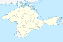
| Location of Kirovske in Crimea | |||
| Coordinates: 45°13′25″N 35°12′19″E / 45.22361°N 35.20528°ECoordinates: 45°13′25″N 35°12′19″E / 45.22361°N 35.20528°E | |||
| Republic | Crimea | ||
| District | Kirovske Raion | ||
| First mentioned | 1783 | ||
| Town status | 1957 | ||
| Government | |||
| • Town Head | Yevhen Ravych | ||
| Area | |||
| • Total | 5.99 km2 (2.31 sq mi) | ||
| Elevation | 23 m (75 ft) | ||
| Population (2014) | |||
| • Total | 6,883 | ||
| • Density | 1,100/km2 (3,000/sq mi) | ||
| Time zone | MSK (UTC+4) | ||
| Postal code | 96400 | ||
| Area code | +380 6558 | ||
| Climate | Cfa | ||
| Website | http://rada.gov.ua/ | ||
Kirovske (Ukrainian: Кіровське; Russian: Кировское; Crimean Tatar: İslâm Terek) (until 1944, İslâm Terek) is an urban-type settlement in the Crimea, a territory recognized by a majority of countries as part of Ukraine and incorporated by Russia as the Republic of Crimea. Population: 6,883 (2014 Census).
Kirovske also serves as the administrative center of the Kirovske Raion (district), housing the district's local administration buildings.
As of the 2001 Ukrainian Census, its population was 7,431.
...
Wikipedia


