King Island Airport
| King Island Airport | |||||||||||||||||||
|---|---|---|---|---|---|---|---|---|---|---|---|---|---|---|---|---|---|---|---|
| Summary | |||||||||||||||||||
| Airport type | Public | ||||||||||||||||||
| Operator | King Island Council | ||||||||||||||||||
| Serves | King Island | ||||||||||||||||||
| Location | Currie, Tasmania | ||||||||||||||||||
| Elevation AMSL | 132 ft / 40 m | ||||||||||||||||||
| Coordinates | 39°52′39″S 143°52′42″E / 39.87750°S 143.87833°ECoordinates: 39°52′39″S 143°52′42″E / 39.87750°S 143.87833°E | ||||||||||||||||||
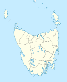
| Map | |||||||||||||||||||
| Location in Tasmania | |||||||||||||||||||
| Runways | |||||||||||||||||||
|
|||||||||||||||||||
|
Sources: Australian AIP and aerodrome chart
|
|||||||||||||||||||
King Island Airport (IATA: KNS, ICAO: YKII) is a small regional airport located near the town of Currie on King Island off the north-west coast of Tasmania, Australia. The airport is owned and operated by the King Island Council.
The airport was the site of a light plane crash on 26 November 1998, when a Piper Lance crashed shortly after take off on its way to Moorabbin, Victoria, killing three Melbourne nurses on board. It was suspected that a strong gust of wind just after take off caused the plane to stall and crash.
...
Wikipedia

