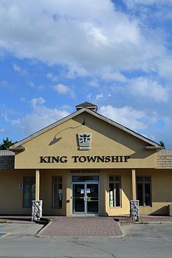
King, Ontario
| King | |
|---|---|
| Township (lower-tier) | |
| Township of King | |
 |
|
 Location of King within York Region. |
|
| Location of King within York Region. | |
| Coordinates: 44°02′47″N 79°36′16″W / 44.04630°N 79.60440°WCoordinates: 44°02′47″N 79°36′16″W / 44.04630°N 79.60440°W | |
| Country |
|
| Province |
|
| Regional Municipality | York Region |
| Settled | 1800 |
| Incorporated | 1850 (township) |
| Government | |
| • Mayor | Steve Pellegrini |
| Area | |
| • Total | 333.30 km2 (128.69 sq mi) |
| Population (2011) | |
| • Total | 19,899 |
| • Density | 59.7/km2 (155/sq mi) |
| Time zone | EST (UTC-5) |
| • Summer (DST) | EDT (UTC-4) |
| Forward sortation area | L0G and L7B |
| Area code(s) | 905 and 289 |
| Website | www.king.ca |
King (2011 population 19,899) is a township in York Region north of Toronto, within the Greater Toronto Area in Ontario, Canada.
The rolling hills of the Oak Ridges Moraine are the most prominent visible geographical feature of King. The Holland Marsh, considered to be Ontario's "vegetable basket", straddles King Township and Bradford West Gwillimbury. King is known for its horse and cattle farms.
Though King is predominantly rural, most of its residents inhabit the communities of King City, Nobleton, and Schomberg.
Lieutenant-Governor John Graves Simcoe named King Township for John King (1759–1830), an English Under-Secretary of State for Home Office from 1794 to 1801 for the Home Department in the Portland administration when Robert Jenkinson, 2nd Earl of Liverpool was Secretary of State.
The township was created as part of the subdivision of York County, itself a subdivision of the Home District. The lands were originally acquired by the British in an agreement with the Mississaugas, known as the Toronto Purchase; it was enacted in British parliament as the Toronto Purchase Act in 1787. Acquisition of the lands for the townships of Etobicoke, King, Vaughan, and York, Upper Canada was completed at a meeting between the Mississaugas and the British at the Credit River on 1 August 1805, where 250,808 acres (1,014.98 km2) were exchanged for £1,700.
...
Wikipedia

