Khejuri I
|
Khejuri I খেজুরী I |
|
|---|---|
| Community development block সমষ্টি উন্নয়ন ব্লক |
|

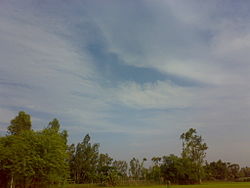
Typical view of Khejuri rural area
|
|
| Location in West Bengal, India | |
| Coordinates: 21°51′08″N 87°47′07″E / 21.8522581°N 87.7852249°ECoordinates: 21°51′08″N 87°47′07″E / 21.8522581°N 87.7852249°E | |
| Country |
|
| State | West Bengal |
| District | Purba Medinipur |
| Government | |
| • Type | Community development block |
| Area | |
| • Total | 130.51 km2 (50.39 sq mi) |
| Elevation | 5 m (16 ft) |
| Population (2011) | |
| • Total | 132,992 |
| • Density | 1,000/km2 (2,600/sq mi) |
| Languages | |
| • Official | Bengali, English |
| Time zone | IST (UTC+5:30) |
| PIN | 721430 (Haria) 721432 (Kalagachia) |
| Area code(s) | 03224 |
| ISO 3166 code | IN-WB |
| Vehicle registration | WB-29, WB-30, WB-31, WB-32, WB-33 |
| Literacy | 88.90% |
| Lok Sabha constituency | Kanthi |
| Vidhan Sabha constituency | Khejuri |
| Website | purbamedinipur |
| Howrah–Kharagpur line | ||||||||||||||||||||||||||||||||||||||||||||||||||||||||||||||||||||||||||||||||||||||||||||||||||||||||||||||||||||||||||||||||||||||||||||||||||||||||||||||||||||||||||||||||||||||||||||||||||||||||||||||||||
|---|---|---|---|---|---|---|---|---|---|---|---|---|---|---|---|---|---|---|---|---|---|---|---|---|---|---|---|---|---|---|---|---|---|---|---|---|---|---|---|---|---|---|---|---|---|---|---|---|---|---|---|---|---|---|---|---|---|---|---|---|---|---|---|---|---|---|---|---|---|---|---|---|---|---|---|---|---|---|---|---|---|---|---|---|---|---|---|---|---|---|---|---|---|---|---|---|---|---|---|---|---|---|---|---|---|---|---|---|---|---|---|---|---|---|---|---|---|---|---|---|---|---|---|---|---|---|---|---|---|---|---|---|---|---|---|---|---|---|---|---|---|---|---|---|---|---|---|---|---|---|---|---|---|---|---|---|---|---|---|---|---|---|---|---|---|---|---|---|---|---|---|---|---|---|---|---|---|---|---|---|---|---|---|---|---|---|---|---|---|---|---|---|---|---|---|---|---|---|---|---|---|---|---|---|---|---|---|---|---|---|
| ||||||||||||||||||||||||||||||||||||||||||||||||||||||||||||||||||||||||||||||||||||||||||||||||||||||||||||||||||||||||||||||||||||||||||||||||||||||||||||||||||||||||||||||||||||||||||||||||||||||||||||||||||

