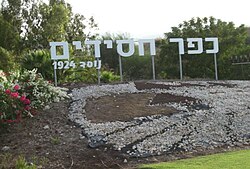
Kfar Hasidim
| Kfar Hasidim | |
|---|---|
 |
|
| Coordinates: 32°44′36″N 35°5′37″E / 32.74333°N 35.09361°ECoordinates: 32°44′36″N 35°5′37″E / 32.74333°N 35.09361°E | |
| District | Haifa |
| Council | Zevulun |
| Founded | 1924 |
| Founded by | Polish immigrants |
| Population (2015) | 798 |
Kfar Hasidim (Hebrew: כְּפַר חֲסִידִים, lit. Village of Hasidim), also known as Kfar Hasidim Alef to distinguish it from Kfar Hasidim Bet, is a moshav in northern Israel. Located near Kiryat Ata, it falls under the jurisdiction of Zevulun Regional Council. In 2015 it had a population of 798.
During the Ottoman era was here a Muslim village called Harbaj. In 1162 A.H (~1748 CE) it was fortified by Zahir al-Umar, and traces of the wall still existed in the late 19th century. The village appeared as El Harchieh on the map that Pierre Jacotin compiled in 1799.
In 1875, Victor Guérin found here about 30 houses, still inhabited. In the centre of the village was a large well, partly filled. In 1881, the Palestine Exploration Fund's Survey of Western Palestine described El Harbaj as “a small adobe village, on the plain, with a well to the north and olives to the east.”
A population list from about 1887 showed that el Harbaj had about 75 inhabitants; all Muslims.
In the 1922 census of Palestine conducted by the British Mandate authorities, Harbaj had a population 177, all Muslims.
Kfar Hasidim was founded in 1924 by two groups of Polish Hasidic immigrants of the Fourth Aliyah, followers of Rabbi Yehezkel Taub and Rabbi Israel Hoffstein, the rabbis of Kozienice and Yablono. They bought land east of Haifa Bay with the help of Rabbi Yeshayahu Shapira of Hapoel Hamizrachi and established Nahalat Ya’akov and Avodat Yisrael, which later merged into Kfar Hasidim.
...
Wikipedia

