Keylong
|
Keylong केलांग |
|
|---|---|
| city | |

Keylong, viewed from Kardang Monastery
|
|
| Coordinates: 32°35′N 77°02′E / 32.58°N 77.03°ECoordinates: 32°35′N 77°02′E / 32.58°N 77.03°E | |
| Country | India |
| State | Himachal Pradesh |
| District | Lahaul and Spiti |
| Elevation | 3,080 m (10,100 ft) |
| Population | |
| • Total | 1,150 |
| Languages | |
| • Official | Hindi |
| Time zone | IST (UTC+5:30) |
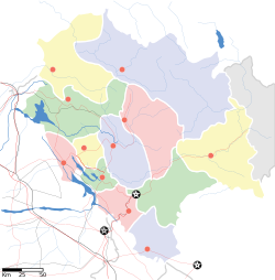
Keylong (or Kyelong or Kyelang) is the administrative centre of the Lahaul and Spiti district in the Indian state of Himachal Pradesh, 126 km (78 mi) north of Manali and 120 km (75 mi) from the Indo-Tibetan border. It is located along the Manali-Leh Highway, about 7 km (4.3 mi) north-east of intersection of the Chandra Valley, the Bhaga Valley, and the Chenab Valley; on the banks of Bhaga River.
Keylong faces the famous Kardang Monastery, the largest and most important monastery in Lahaul, of the Drukpa sect of Tibetan Buddhism, which is on a slope across the river from Keylong.
Sights near Keylong include the Kardang, Shasur, and Tayul monasteries, all within a few kilometres of Keylong. There is also a small temple dedicated to the local deity Kelang Wazir in the house of Shri Nawang Dorje that may be visited upon arrangement.
The annual Lahaul Festival is held here each July with a big, busy market and a number of cultural activities. In end of August it became very busy.
Keylong is the district headquarters of Lahaul and Spiti district and is home to most of the government offices and facilities in Lahaul, and also hosts a regular bazaar.
There are some tourist facilities including a Circuit House, a Public Works Department (PWD) Rest House, a Sainik (Army) Rest House, a Tourist Bungalow, and a number of small hotels. Keylong is known for its wide range of hotels.
Keylong is accessed from Manali by Manali-Leh Highway, a part of NH21. It is located about 125 km (78 mi) north of Manali. It is located at an altitude of 3,080 m (10,100 ft) and cut off from the outside world from October-end to mid-May due to heavy snowfall at Rohtang Pass that closes the pass during the winter.
The peak travel season is during May and June when a lot of tourists visit Rohtang pass. There are enough buses in summer season from manali. The time taken is 4 to 10 hours depending upon the condition of the road (that sometimes becomes too slippery because of snowfall) and traffic jam that occurs at Rohtang pass and Beas nallah near Marhi. It is advisable to cross Rohtang pass before 8 am.
...
Wikipedia


