Kemper County, Mississippi
| Kemper County, Mississippi | |
|---|---|
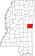
 Location in the U.S. state of Mississippi |
|
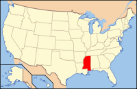
 Mississippi's location in the U.S. |
|
| Founded | 1833 |
| Named for | Reuben Kemper |
| Seat | De Kalb |
| Largest Town | De Kalb |
| Area | |
| • Total | 767 sq mi (1,987 km2) |
| • Land | 766 sq mi (1,984 km2) |
| • Water | 0.8 sq mi (2 km2), 0.1% |
| Population | |
| • (2010) | 10,456 |
| • Density | 14/sq mi (5/km²) |
| Congressional district | 3rd |
| Time zone | Central: UTC-6/-5 |
Kemper County is a county located in the U.S. state of Mississippi. As of the 2010 census, the population was 10,456. Its county seat is De Kalb. The county is named in honor of Reuben Kemper.
The county is part of the Meridian, MS Micropolitan Statistical Area.
United States Senator John C. Stennis, who served from 1947 to 1988, was born in Kemper County. Another Kemper County native was Texas Ranger Captain Bill McDonald.
East Mississippi Community College is located in Kemper County in the town of Scooba, at the junction of US 45 and Mississippi Highway 16.
In 1934, three African American defendants from Kemper County were forced to confess to murder after being repeatedly whipped. In Brown v. Mississippi, the U.S. Supreme Court unanimously ruled the forced confessions were inadmissible.
According to the U.S. Census Bureau, the county has a total area of 767 square miles (1,990 km2), of which 766 square miles (1,980 km2) is land and 0.8 square miles (2.1 km2) (0.1%) is water.
As of the 2010 United States Census, there were 10,456 people residing in the county. 60.1% were Black or African American, 35.3% White, 3.7% Native American, 0.1% Asian, 0.1% of some other race and 0.7% of two or more races. 0.5% were Hispanic or Latino (of any race).
...
Wikipedia
