Kearny Mesa, San Diego
| Kearny Mesa, San Diego | |
|---|---|
| Community of San Diego | |
| Kearny Mesa | |

Convoy Street in Kearny Mesa
|
|
| Location within Northwestern San Diego | |
| Coordinates: 32°49′30″N 117°08′21″W / 32.825°N 117.139167°W | |
| Country | |
| State |
|
| County |
|
| City |
|
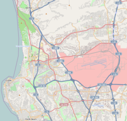
Kearny Mesa is a community in the eastern part of San Diego, California. It is located in the area of the city that is bounded by State Route 52 to the north, Interstate 805 to the west, Aero Drive to the South, and Interstate 15 to the east. Adjacent communities include Serra Mesa, Clairemont and Tierrasanta.
Kearny Mesa has a population of 2,837.
Kearny Mesa is named for the former Camp Kearny, a U.S. military base which operated in the area from 1917 to 1946 and eventually became Marine Corps Air Station Miramar. Camp Kearny in turn was named for Brigadier General Stephen W. Kearny, a leader in the Mexican-American War who also served as a military governor of California. While General Kearny's name was pronounced "Car-nee" during his lifetime, San Diegans use the "Cur-nee" pronunciation.
The urbanization of Kearny Mesa began in 1937 with Gibbs Airfield, now the small airfield Montgomery Field named after pioneer glider pilot John J. Montgomery. In 1948, the City of San Diego acquired the airfield and 1,400 acres (6 km2) of surrounding property as a possible replacement site for San Diego International Airport. However, airspace conflicts with MCAS Miramar (at that time NAS Miramar) made the proposed airport infeasible. Montgomery Field was restricted to small aircraft, and the surplus land was converted to an industrial park.
...
Wikipedia

