Tierrasanta
| Tierrasanta, San Diego | |
|---|---|
| Community of San Diego | |
| Tierrasanta | |

The Tierrasanta sign located on Santo Road
|
|
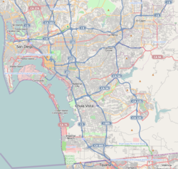
| Location within San Diego | |
| Coordinates: 32°49′15″N 117°05′47″W / 32.820833°N 117.096389°W | |
| Country | |
| State |
|
| County |
|
| City |
|
| Elevation | 108 m (354 ft) |
| Highest elevation | 240 m (780 ft) |
| Lowest elevation | 50 m (180 ft) |
| Population (2010) | |
| • Total | 30,443 |
| Area code(s) | 858 |
Tierrasanta, Spanish for "holy land," or "holy ground", is a community within the city of San Diego, California. The symbol of Tierrasanta is an encircled Conquistador cross, similar to one atop Montserrat (mountain) near Barcelona, Spain, though it no longer holds any religious meaning. The community is referred to as "The Island in the Hills" by locals and on welcome signs.
Tierrasanta was originally part of the Mission San Diego de Alcalá ranch, which was active during the late 18th and 19th centuries. The U.S. military purchased the land in 1941 as Camp Elliott, a Marine Corps training facility. The Marines moved out in 1944 and the land was transferred to the Navy. It was deactivated in 1946. In 1961, the U.S. Government sold the area that is now Tierrasanta and a portion of neighboring Mission Trails Regional Park to the City of San Diego. In the following year, the Elliott Community Plan was issued to serve as a roadmap for development going forward, and in 1971 Tierrasanta was founded. The current Tierrasanta community plan was first issued in 1982, and included both the currently developed area and much of what is now Mission Trails Regional Park. By 1982 approximately one-half of the private residential area had been developed, with the area called Tierrasanta Norte, in the northeastern part of town, being one of the locations still to be developed. Tierrasanta has been almost fully built out since the early 1990s, and in 2010 had a population of 30,443 (ZIP code 92124). Some 2,300 homes grouped in the southwest portion of town are part of the Murphy Canyon military housing complex. Tierrasanta was one of the first master planned communities in San Diego.
Because of the area's history as a military training base, some military debris including unexploded ordnance remained in the area when it was developed, in spite of multiple cleanup efforts by different branches of the services. In 1983 two 8-year-old Tierrasanta boys were killed after discovering unexploded ordnance in a canyon near their home. The Navy performed surface clearance operations in 1984 and 1985. Between 1990 and 1995 the U.S. Army Corps of Engineers removed several tons of ordnance and debris under its FUDS (Formerly Used Defense Sites) program. The Corps continues to monitor the area.
...
Wikipedia

